Printable Blank Map of Alaska for Download [JPEG/PDF]
Download from this page your blank map of Alaska as an image or PDF file in A4 or A5 format. Just click on the relevant download link under each image to get your free Alaska outline map.
While there are many blank Alaska maps available on the internet, our collection is unique because we provide not only a simple outline map but also several blank map variations. Our cartography and GIS experts have created maps with markers for borough seats as well as state and borough borders, covering a wide range of possible uses.
Whether you’re a teacher, student, researcher, or traveler, our blank Alaska maps are crafted to meet your diverse needs. Use them for lesson planning, creating worksheets and presentations, and planning or tracking your trips. Check out our maps now!
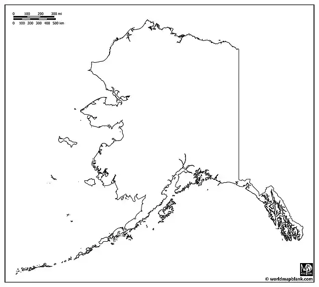
Outline Map of Alaska
Alaska, known as “The Last Frontier” due to its vast wilderness and being the most northerly and westerly state in the United States, is located in the northwest extremity of the country’s West Coast. It is bordered by Canada to the east, the Arctic Ocean to the north, and the Pacific Ocean to the south and west.
Download as PDF (A4)
Download as PDF (A5)
Download as JPEG (HD)
Our Alaska outline map above provides a clear depiction of the state’s outer boundaries. It is an excellent tool for geographical education about this U.S. state. It is best for drawing, shading, and marking exercises. For instance, teachers can ask their students to mark major natural landmarks like Denali (the highest peak in North America), the Inside Passage, or the Aleutian Islands on the map.
Blank Alaska Borough Map
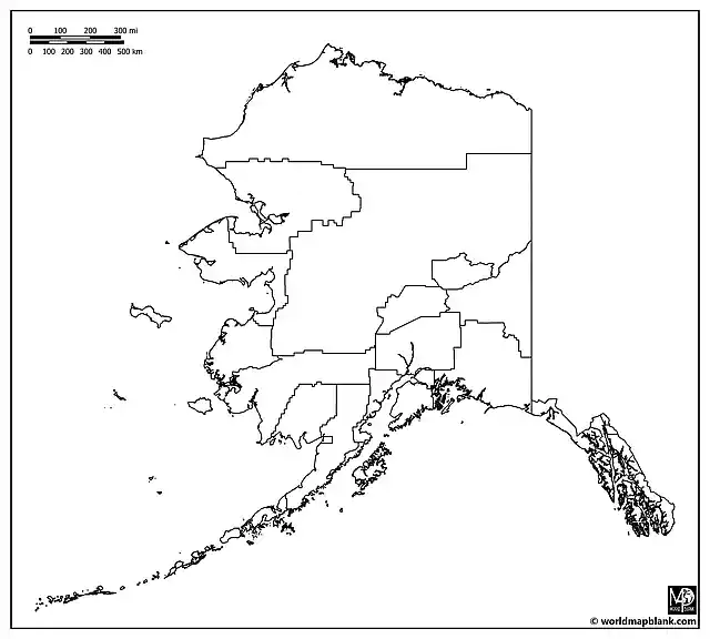
Alaska is divided into 19 organized boroughs and one unorganized borough. Apart from Louisiana, where the administrative divisions are called “parishes”, it is the only U.S. state not using the name “county”. The following map shows all Alaska borough borders. It is perfect for a range of activities, from demographic studies to exploring the rich history and vast geography of areas like the North Slope Borough, Juneau Borough, or the Kenai Peninsula Borough.
Download as PDF (A4)
Download as PDF (A5)
Download as JPEG (HD)
A possible classroom activity could involve students researching a particular borough and presenting its economic, cultural, or historical attributes. The map can also be used for plotting natural wonders, such as national parks, wildlife refuges, and glaciers.
Blank Map of Alaska with Borough Seats
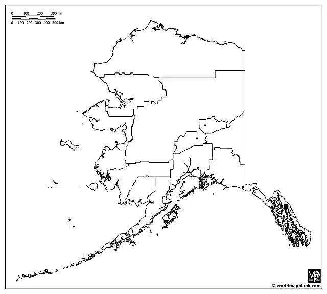
Each of Alaska’s boroughs has a borough seat that serves as its administrative center. This detailed map not only outlines the boroughs but also marks their respective borough seats, offering a comprehensive view of Alaska’s administrative geography.
Download as PDF (A4)
Download as PDF (A5)
Download as JPEG (HD)
The above map can be used for learning and memorizing all the borough and borough seat names. For learning activities or exams, use a list of Alaska’s boroughs as your answer key. Alternatively, you can download and refer to our black-and-white Alaska map further below.
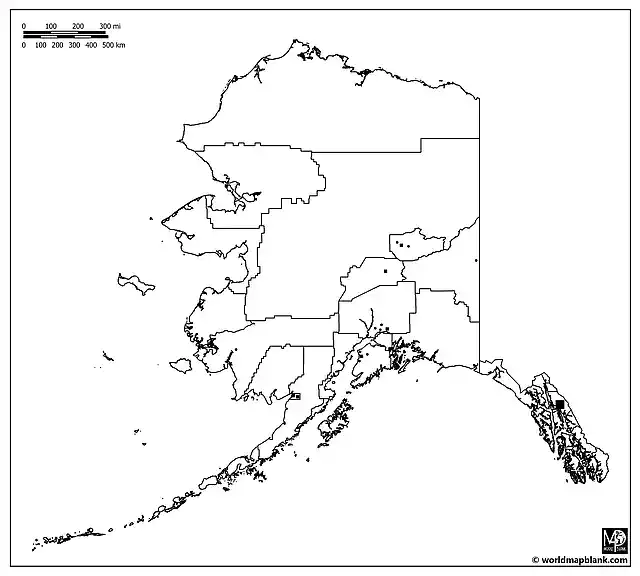
Blank Alaska Map with Cities and Towns
Besides the state capital, Juneau, Alaska has a few more significant cities, such as Anchorage, Fairbanks, Sitka, and Ketchikan. The following map includes markers for these and other cities and towns, offering an excellent resource for learning even more about the urban and rural areas in Alaska.
Download as PDF (A4)
Download as PDF (A5)
Download as JPEG (HD)
The additional smaller cities and towns marked on the map include Badger, Bethel, College, Kalifornsky, Kenai, Meadow Lakes, Steele Creek, Sterling, Tanaina, and Wasilla.
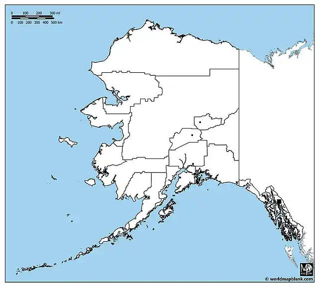
Blank Map of Alaska with Canada
Our following blank map of Alaska includes the border with Canada as well as the Arctic Ocean, the Pacific Ocean, and the Bering Sea. This detailed map is our most comprehensive unlabeled Alaska map, combining features of all other maps. It’s an excellent resource for teaching or learning about Alaska in relation to Canada and the surrounding water bodies.
Download as PDF (A4)
Download as PDF (A5)
Download as JPEG (HD)
The map above can also serve in tests and exams where students have to mark or label all geographical and administrative features of Alaska on the map.
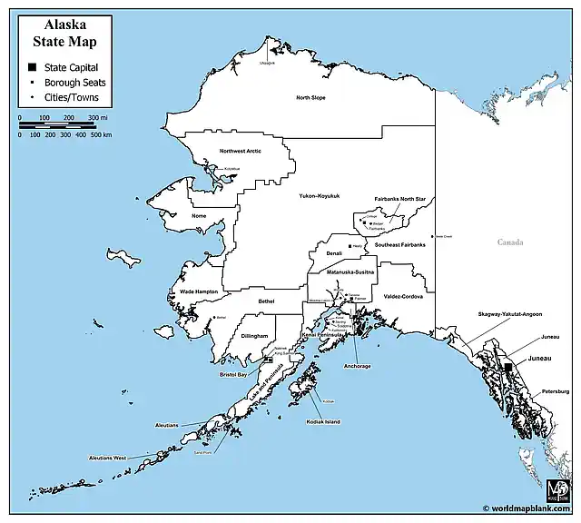
Alaska Map Black and White
Our last map is a black-and-white map of Alaska with all features labeled. You can use this map as an answer key or reference map. Also, it might serve for coloring exercises or for illustration purposes without distracting colors.
Download as PDF (A4)
Download as PDF (A5)
Download as JPEG (HD)
Feel free to download all of the maps from this page to create your complete collection of blank maps of Alaska. When using our maps, please make sure you adhere to our licensing terms.
Related Maps
We offer many more blank and labeled U.S. state maps and other related maps for free download. Here are some examples:
- USA Map with States
- Outline Map of Texas
- Blank Map of California
- North America Outline Map
- Blank Map of the United States
Explore our collection to find the perfect map for your educational, research, professional, or travel planning needs. All our maps are available in convenient formats and are easy to print, ensuring you have the best resources at your fingertips. For easy lesson planning, also check out our map worksheets with U.S. states.
With maps created by:
Edelweise Shane Angeles is a skilled GIS Analyst and Cartographer from Davao City, Philippines. Holding a Bachelor's in Geology and Earth Science, he specializes in creating practical, clear maps using tools like Global Mapper, ArcGIS, ArcMap, and Google Earth Pro. Edelweise creates both blank and labelled maps for World Map Blank.


