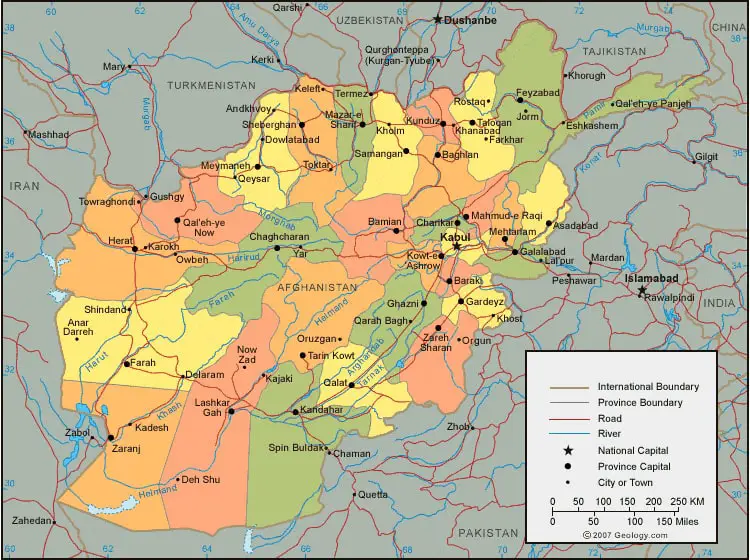
Labeled Map of Afghanistan with States, Capital & Cities
Afghanistan Labeled Map enables the user to have knowledge about the details of Afghanistan and neighboring countries surrounding it. The map, includes further details, like location of rail roads and airports; main roads that connect the various cities in the country. Besides, the map also shows other details, such as the location of major cities, provincial capitals, national capital and international borders.
- World map with continents
- Physical world map
- Political world map
- Labeled map of Asia
- Labeled map of Africa
- Labeled map of Europe
- Labeled map of Antarctica
- Labeled map of South America
- World time zone map
- Labeled map of World
- World map with Latitude
- Blank map of world
- Labeled map of North America
- Blank map of Asia
- World map with oceans
- World map poster
Labeled Map of Afghanistan
In Central Asia, Afghanistan is recognized as a mountainous land locked republic. The country is bordered by Iran in the west, Uzbekistan, Turkmenistan and Turkmenistan in the north. The map shows a small stretch of border in the north east indicating both India and China.
It also indicates Pakistan in the direction of east and south. The total area occupied by the country is about 652,000 km². Hilmand river is the largest river that flows from the spring of the mouth of Afghanistan’s territory. Amu Darya river in the north, is one of the greatest and very important rivers, which flows in Afghanistan. The total population of Afghanistan is 38,928,346 people. This is updated as on June 20, 2020.
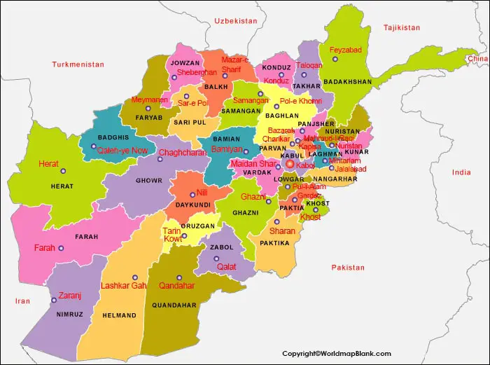
Labeled Map of Afghanistan with States
While looking into the labeled map of Afghanistan with states, it can be observed that the country has thirty-four states or provinces. They are recognized as the major administrative divisions. Each province comprises several districts or may be more than one thousand villages. Names of these provinces or states, include Badakhshan, Badghis, Baghlan, Balkh, Bamyan, Daykundi, Farah, Faryab, Ghazni, Ghor, Helmand, Herat, Jowzjan, Kabul, Kandahar, Kapisa, Khost, Kunar, Kunduz, Laghman, Logar, Nangarhar, Nimruz, Nuristan, Paktia, Paktika, Panjshir, Parwan, Samangan, Sar-e Pol, Takhar, Uruzgan, Wardak, and Zabul. The governments of these provinces are headed by a governor.
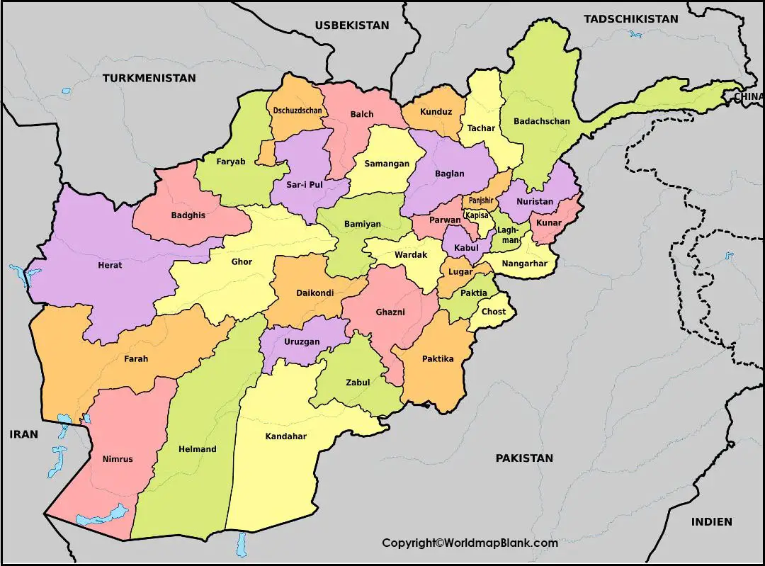
The President of the country appoints them. Two members in the House of Elders are represented in each province of the government of Afghanistan.
Labeled Map of Afghanistan with Cities
Major cities according to the labeled map of Afghanistan, include Kabul, Herat, Kandahar, Mazār-e Sharīf, Jalālābad, Konduz, Pol-e Khomrī, Meymaneh, Sheberghān, and Lashkar Gāh. Kabul, being the first largest city. It is followed by Kandahar, the second-largest city of Afghanistan. It is situated in the southern region of Afghanistan. Herat, is third largest city of the country.
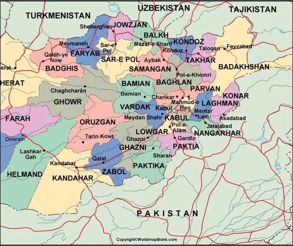
This is located in the western region of Afghanistan. All the people of Afghanistan are Muslims, out of which Sunnis are nearly eighty percent. They belong to a religion known as Hanafi. The remaining people belong to Kizilbash and Hazara community. They follow either Twelver or Ismāʿīlī Shiʿi Islam religion. It has been found that Sufism is considered to be historically a powerful religion in Afghanistan. Apart from all this, there are a few Sikhs and Hindus.
Labeled Afghanistan with Capital
Labeled Afghanistan with capital reflects that Kabul is the capital city of Afghanistan. It is the largest city in the country. It is full of mosques and gardens with a serene atmosphere. Kabul is the major city of Afghanistan. It has population of one million.
Related Posts


