Labeled Map of Algeria with States, Capital & Cities
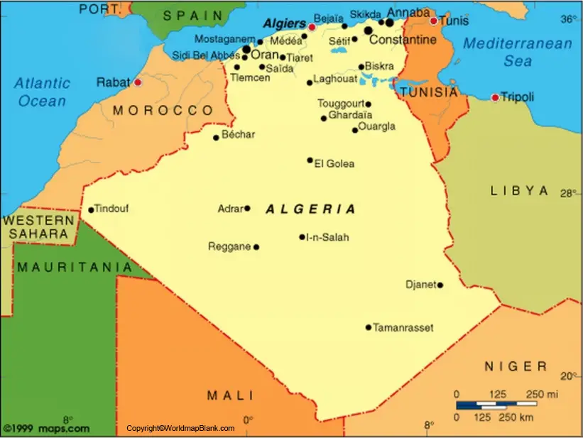
While referring to the Algeria Labeled Map, it can be inferred that the country of Algeria is located in the northwestern region of Africa. In the north, Algeria borders with the Mediterranean Sea, and in the west, with Morocco.
- World map with continents
- Physical world map
- Political world map
- Labeled map of Asia
- Labeled map of Africa
- Labeled map of Europe
- Labeled map of Antarctica
- Labeled map of South America
- World time zone map
- Labeled map of World
- World map with Latitude
- Blank map of world
- Labeled map of North America
- Blank map of Asia
- World map with oceans
- World map poster
And in the southwest and southeast, it is bordered with Mauritania and Mali, and Niger, respectively. Algeria is bordered with Libya and Tunisia is available in the east. It shares a small border stretching to Western Sahara in the western direction. The country shares maritime borders with Spain and Italy. As of Sunday, July 12, 2020, the present population of Algeria is 43,869,754. This population is equivalent to 0.56 percent of the total global population. There are five long rivers in Algeria.
Labeled Map of Algeria
They include, Chelif with a total length of 435 miles, Djedi with length of 298 miles, Medjerda with 280 miles, Ziz with 175 miles, and Seybouse with 140 miles. The total area of this country is equivalent to 2,381,741 square kilometers or 919,595 sq.miles.
In Algeria, Muslims dominate the religion, accounting to ninety-nine percent of the population. They adhere to Sunni Islam of the Maliki school of jurisprudence. The remaining religions, include Ibadi Muslims, Shia Muslims, Ahmadi, Jews and Christians.
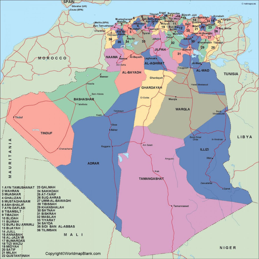
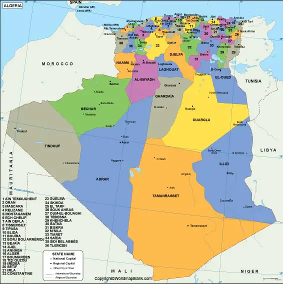
Labeled Map of Algeria with States
The country is divided into fifty-eight provinces or states, since December 2019. The other name given to the province is wilayas in Algeria. These provinces are further divided into 1541 municipalities.
Labeled Map of Algeria with Cities
According to the Labeled Map of Algeria with Cities, the cities and towns are occupied by more than 100,000 inhabitants. Besides, the towns and villages are occupied by 20,000 inhabitants. The biggest cities of Algeria, include Algiers, Oran, Blida, Constantine, Annaba, Djelfa, Biskra, Batna, Setif and Sidi Bel Abbes.
Labeled Algeria with Capital
Based on the Labeled Algeria with Capital, the capital city of Algeria is Algiers. It is located in the region of western shore of the Mediterranean Sea. By population it is considered as the largest city of Algeria. The total estimated population of this city is more than 3.4 million.
It is the metropolitan city of Algeria with approximately a population of five million. The area covered by this megacity is equivalent to 140 square miles. This is further divided into two sections. The old and the modern city. The old city of Algiers is within the hillside and surrounded by the modern part of the city.
For its ancient and uniquely built architecture, this city is famous. It includes a number of villas, cathedrals, and mosques. The great mosque is the oldest construction in Algiers, which was constructed in the earlier part of eleventh century AD. Several other structures are added. Notre-Dame d’Afrique is the oldest cathedral in this city.
This is unique owing to its use of Roman and Byzantine types of architectural styles. A villa known as Villa Abd-el-Tif got constructed in the early part of the twentieth century. It is considered to be famous in this city.
Related Posts


