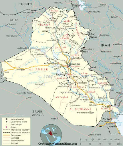
Labeled Map of Iraq with States, Capital & Cities
While looking into the Labeled Map of Iraq, it can be seen that Iraq is a country located in Western Asia. It is designated as the Republic of Iraq. The country is bordered by Iran in the east, Syria in the west, Turkey in the north, Saudi Arabia in the south, Kuwait and Jordon in the southeast and southwest, respectively. Situated in the Middle East, Iraq is an almost landlocked country.
- World map with continents
- Physical world map
- Political world map
- Labeled map of Asia
- Labeled map of Africa
- Labeled map of Europe
- Labeled map of Antarctica
- Labeled map of South America
- World time zone map
- Labeled map of world
- World map with longitude and latitude
- Blank map of world
- Labeled map of North America
- Blank map of Asia
- World map with oceans
- World map poster
Labeled Map of Iraq
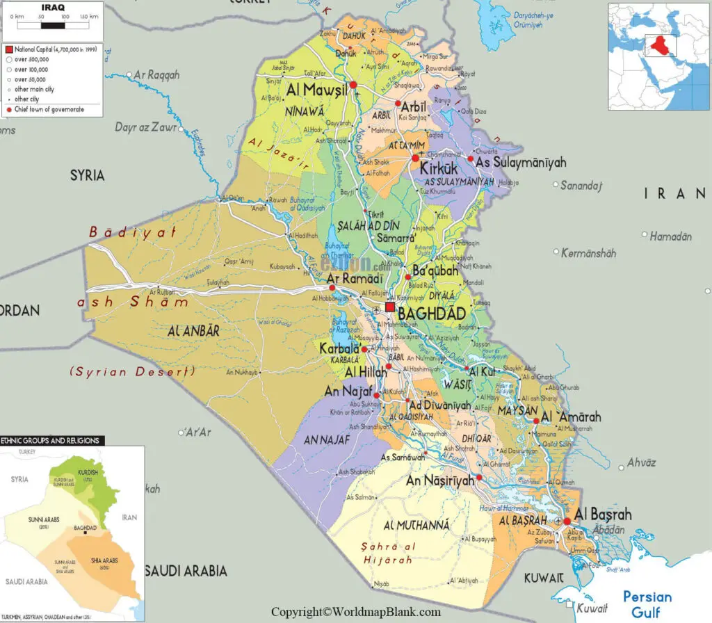
It has a short coastline at the Persian Gulf. The updated population of Iraq stands at 40,278,833 people, as on Monday, July 27, 2020. This is based on the Worldmeter reflected through the updated data of the United Nations. Besides, the population of Iraq is equivalent to 0.52% of the global population. The total land area is equivalent to 438,446 square kilometers or 169,285 square miles.
In Iraq, about 98% of people follow Islamic religion, out of which fifty-one percent are of Shia region and forty-two percent follow Sunni religion. The remaining five percent are recognized as just Muslims. Other religions followed, include Christianity, Yazidism, Mandaeism and other religions. The country has two major rivers, known as the Euphrates and Tigris. Other rivers, include Diyala, Little Zab and Great Zab that flow through the country.
Labeled Map of Iraq with States
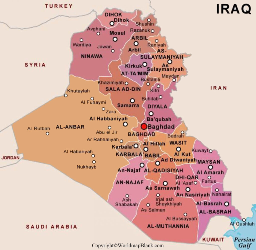
As a part of the labeled map of Iraq with states, the country is divided into nineteen governorates, known as provinces. Some of the important names of the governorates, include Maysan, Al Anbar, Erbil, and Baghdad.
Labeled Map of Iraq with Cities
Through the labeled map of Iraq with cities, the country has five cities with more than a million people. It has twenty-two cities with a population ranging between 100,000 and one million people. The country has forty-three cities in which the population ranges between 10,000 and 100,000 people. The ten big cities, include Baghdad, Basra, Hillah, Najaf, Karbala, Erbil, Sulaymaniya, Al Nasiriya, and Kirkuk.
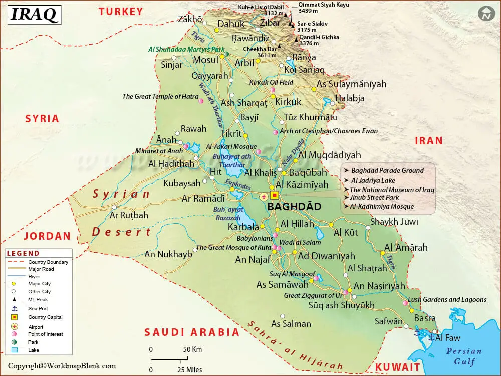
Labeled Map of Iraq with Capital
According to the labeled map of Iraq with capital, it can be seen that Baghdad is recognized as the largest city and the capital city of Iraq. The city’s estimated population is equivalent to 7,180,889 people. Baghdad is also recognized as the second-largest city, both in Western Asia and in the Arab World, after Tehran and Cairo, respectively.
The city is located on the river Tigris, founded in the eighth century. It has evolved as an intellectual, cultural, and hub of the commercial center. Baghdad with its historical background grew rapidly owing to its excellent location. This helped the great city to have good control over trading routes along the river Tigris. The city has plenty of water supply with a dry climate.
The river Tigris divides it into two, namely, Risafa located on the eastern side, and Karkh on the western side. The city of Baghdad is constructed over a fairly flat and low-lying land of alluvial origin. It is divided into nine districts, and each district is headed by a Mayor.
Related Posts


