Labeled Map of Jamaica with States, Capital & Cities
Jamaica Labeled Map reflects that it is recognized as an Island nation in the Caribbean Sea. It is located in the southeast of Cuba. Hispaniola, also known as, Dominican Republic and Haiti, is situated in the southwest of this island. The lush topography of Jamaica reflects mountains, reef-lined beaches and rainforests.
- World map with continents
- Physical world map
- Political world map
- Labeled map of Asia
- Labeled map of Africa
- Labeled map of Europe
- Labeled map of Antarctica
- Labeled map of South America
- World time zone map
- Labeled map of World
- World map with Latitude
- Blank map of world
- Labeled map of North America
- Blank map of Asia
- World map with oceans
- World map poster
There are several all-inclusive resorts found in this island. They include places like Negril, which is famous for diving and snorkeling sites, and Montego Bay, famous for its British colonial architecture. Jamaica is also famous as it is the origin where reggae music got promoted. As on Tuesday, August 4, the current population of Jamaica stands at 2,962,372 people.
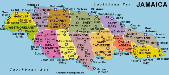
Labeled Map of Jamaica
Jamaica’s total land area measured is equivalent to 10,992 square kilometers. With this area, it can be seen that Jamaica is considered to be bigger than Cyprus. But, it is slightly smaller than the size of the US state of Connecticut. The island’s landscape consists of mostly mountains with narrow coastal plains. The highest point of Jamaica is found in Blue Mountain Peak with a height of 2,256 meters. It is famous for Blue Mountain Coffee. Longest river in Jamaica is named as the Rio Minho. The length of this river 92.5 kilometers. Other rivers that flow in the island, include Rio Nueve, Wag Water River and White River. Religions followed, include Christianity involving Protestants, Roman Catholics, and Jehovah. The other religions, include Rastas, Islam, Buddhism, and Hindus.
Labeled Jamaica Map with States
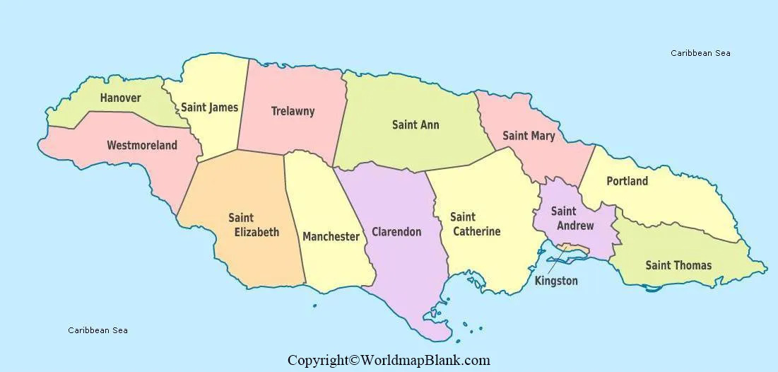
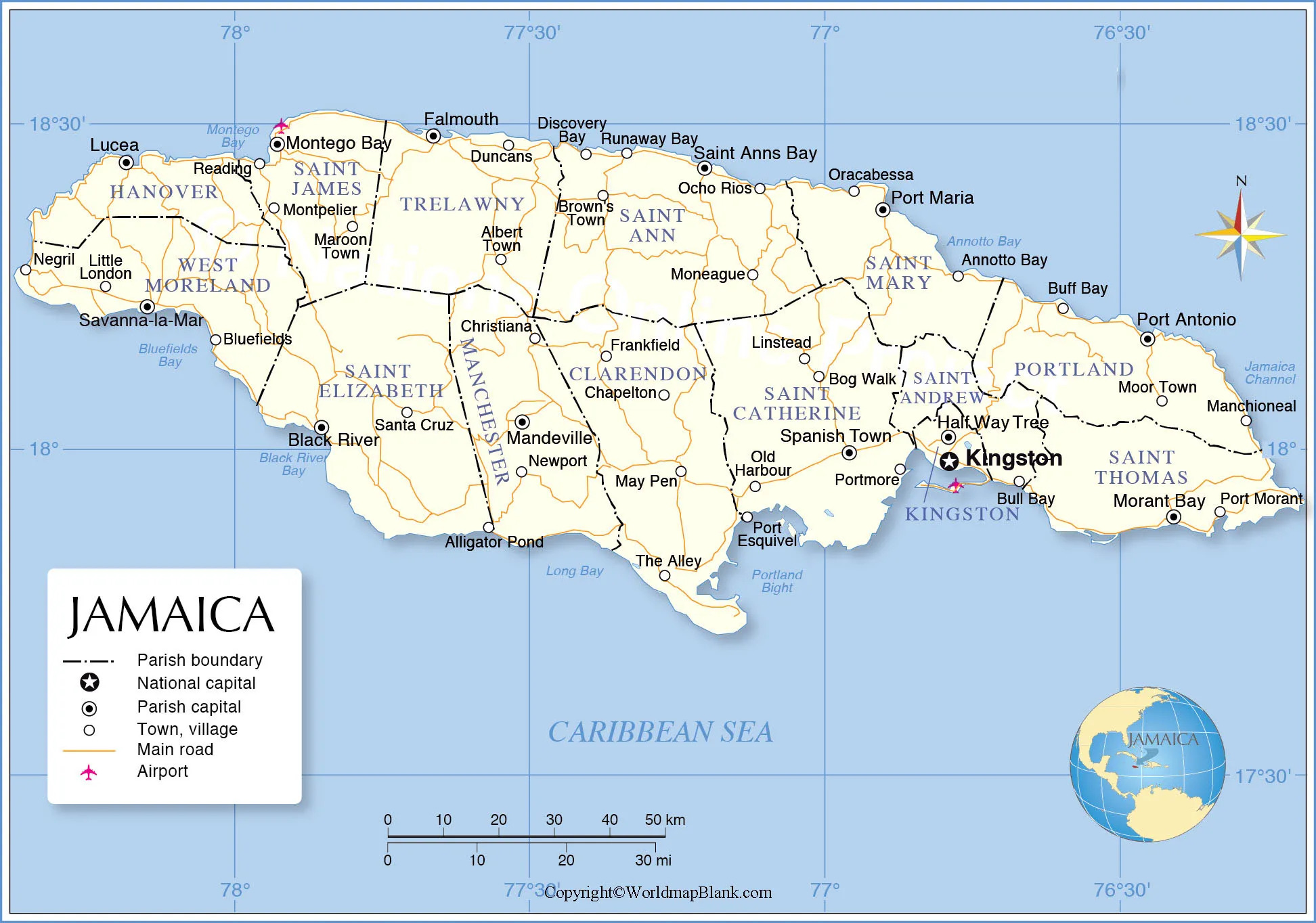
Through the labeled map of Jamaica with states, it can be ascertained that this island is divided into three counties. They are Surrey, Middlesex, and Surrey. These are further divided into fourteen parishes. They include St. Thomas, Portland, St. Mary, St. Ann, Trelawny, St. James, Hanover, Westmoreland, St. Elizabeth, Manchester, Clarendon, St. Catherine, St. Andrew and Kingston. Each parish or province has a capital town, which is recognized as the biggest commercial center.
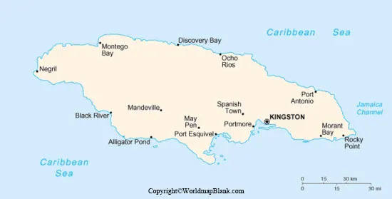
Labeled Map of Jamaica with Cities
As a part of the labeled map of Jamaica with cities, it can be seen that the island has three officially designated cities. The names of these cities, include Montego Bay, Portmore and Kingston. The population of Jamaica is primarily located within the urbanized cities.
Labeled Jamaica with Capital
As a part of labeled Jamaica with capital, Kingston has recognized as the capital city as well as the chief port of this island. This city backed by the Blue Mountains is extended along the southeastern coast of the island. It is famous for its wonderful natural harbor and is well protected by the Palisadoes.
The city has a narrow peninsula that has been developed as a recreational resort for tourists. The city is recognized not only as the capital for business, but also as the epicenter of cultural activities. The main attractions of the city, include Bob Marley Museum, Devon House, Emancipation Park, Hope Botanical Gardens & Zoo, Jamnesia Surf Club, Loose Canon Tours, Port Royal, and the Rockfort Mineral Bath.
Related Posts


