Labeled Map of Kuwait with States, Capital & Cities
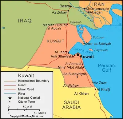
Labeled Map of Kuwait indicates that the State of Kuwait is the official name of the country. This is located in the middle east and on the Arabian Peninsula, bordering the northwestern portion of the Persian Gulf, also known as the Arabian Gulf. The country borders Saudi Arabia and Iraq. It shares maritime boundaries with Iran. The largest Islands, like Failaka, Warbah, and Bubiyan belong to Kuwait.
- World map with continents
- Physical world map
- Political world map
- Labeled map of Asia
- Labeled map of Africa
- Labeled map of Europe
- Labeled map of Antarctica
- Labeled map of South America
- World time zone map
- Labeled map of world
- World map with longitude and latitude
- Blank map of world
- Labeled map of North America
- Blank map of Asia
- World map with oceans
- World map poster
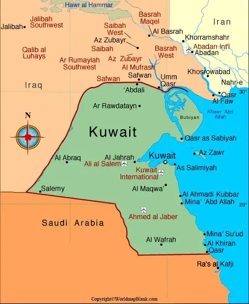
Labeled Map of Kuwait
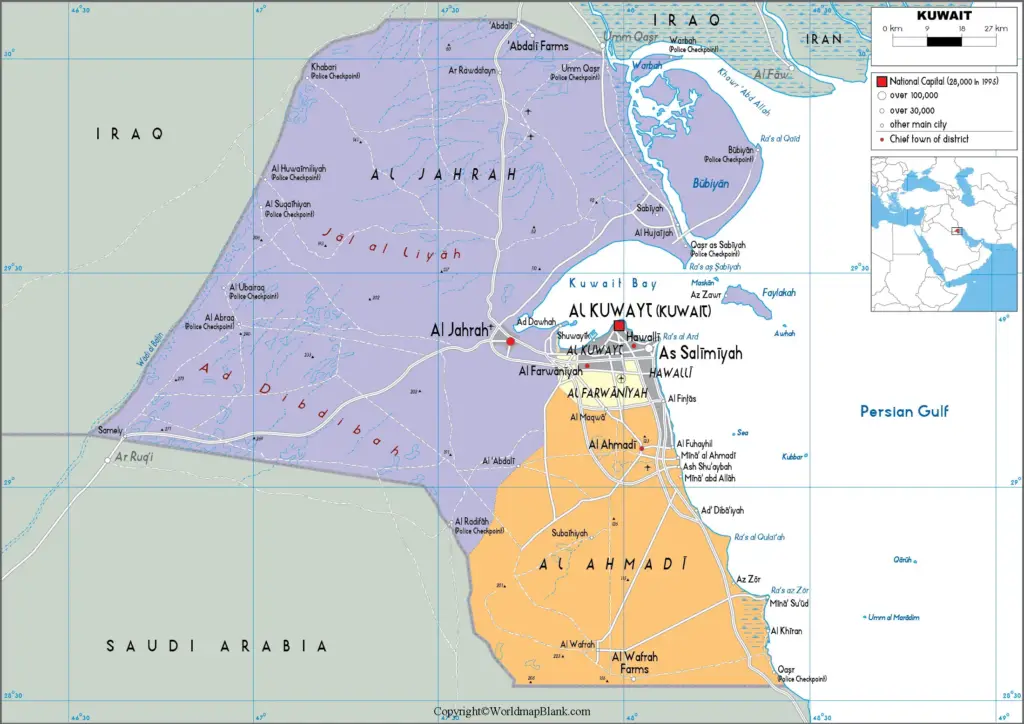
They are situated off the coast of the mainland of Kuwait. As on Friday, August 14, 2020, the current updated population of Kuwait is 4,277,867 people. This population is equivalent to 0.05% of the total global population. The total land area of Kuwait measures about 17,818 square kilometers or 6,880 square miles. With this area, Kuwait is said to be somewhat smaller than two times the size of Cyprus, but slightly smaller than New Jersey, in the US. There are no permanent rivers flowing in the country.
There are river-like channels around Bubiyan Island. Majority of the religion followed is Islam. Other religions, include Christianity and Bahai. Many of the expatriates in Kuwait, include Muslims, Hindus, Buddhists or Christians.
Labeled Kuwait Map with States
As a part of the labeled map of Kuwait with states, it can be said that the provinces in this country are locally known as, Kuwait Governorates. Principally, there are six provinces. The country is divided into five voting districts. The names of these State or Provinces, include Muhafazat Mubarak al Kabir, Muhafazat al Ahmadi, Muhafazat al Farwaniyah, Muhafazat al Jahra’, Al Asimah Governorate and Muhafazat Hawalli.
Labeled Map of Kuwait with Cities
Through the labeled map of Kuwait with cities, Kuwait has four cities with population between 100,000 and 1 million people, and sixteen cities with population between 10,000 and 100,000 people. The names of cities and towns, include Zoor, Wafrah, Salwa, Salmiya, Salmi, Sabah Al Ahmad, Mubarak Al-Kabeer, Messila, Mangaf, Mahboula, Kuwait City, Khiran, Jahra, Hawally, Khiran, Jahra, Fahaheel, Ali Sabah Al Salem, Al Farwaniyah, Ahmadi and Abdali.
Labeled Kuwait Map with Capital
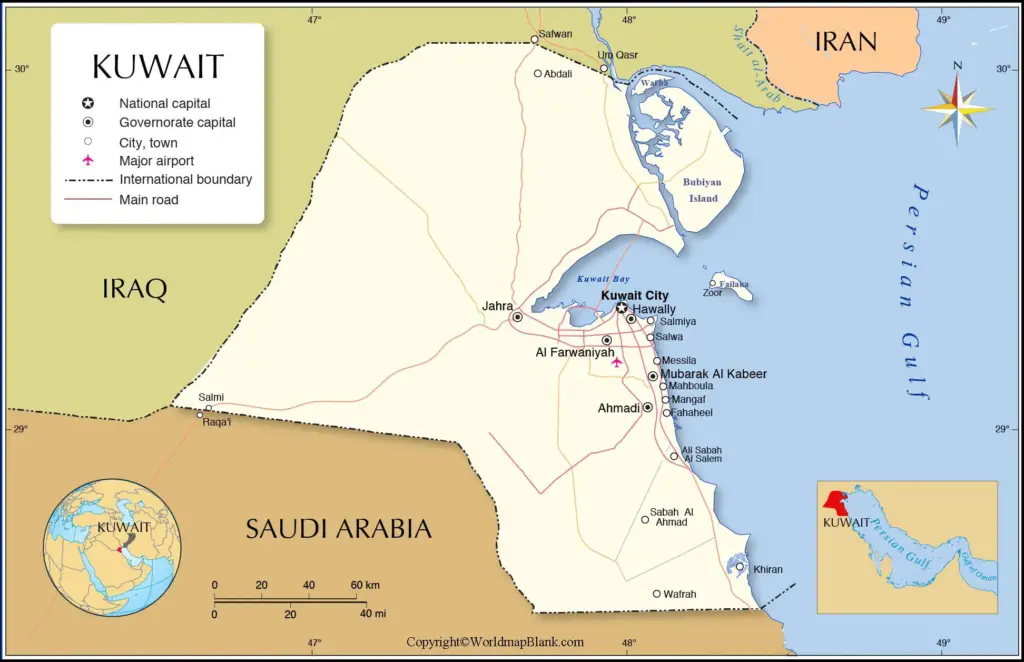
As a part of the labeled Kuwait Map with capital, Kuwait City is the largest and the state national capital of the country. The alternate name given Kuwait City is Madinat Al-Kuwayt. It is on the southern shore of Kuwait Bay on the northern end of the Persian Gulf. Kuwait City is the premier city and the core of the emirate. It is the commercial, cultural and political center of the country. Kuwait City has two major ports. About forty kilometers to the south of Kuwait City, it is possible to find the principal oil port known as Ahmadi. The city has cargo port in the west of the capital, known as Shuwaik Port.
The University of Kuwait is in the city. This is said to be first public institution of the state of Kuwait. It was established in the year 1966. The university includes a College for Women, a College of Education, the College of Arts and the College of Science.
Related Posts


