Labeled Map of Luxembourg with States, Capital & Cities
The Labeled Map of Luxembourg reveals that Luxembourg, officially known as the Grand Duchy of Luxembourg, is a landlocked nation. It is located in the western region of Europe. In the west and north, the country shares international borders with Belgium, in the south with France, and in the east with Germany.
- World map with continents
- Physical world map
- Political world map
- Labeled map of Asia
- Labeled map of Africa
- Labeled map of Europe
- Labeled map of Antarctica
- Labeled map of South America
- World time zone map
- Labeled map of World
- World map with Latitude
- Blank map of world
- Labeled map of North America
- Blank map of Asia
- World map with oceans
- World map poster
Labeled Map of Luxembourg
The geography of Luxembourg indicates that it has two regions. The first one is known as Oesling, part of the Ardennes massif, which is a hilly region. This consists of large deciduous forests in the north. The second region is known as the Gutland, which means a good country. This region is comparatively an urbanized place located in the south. As on Friday, August 21,2020, the current population of Luxembourg is 627,342 people.
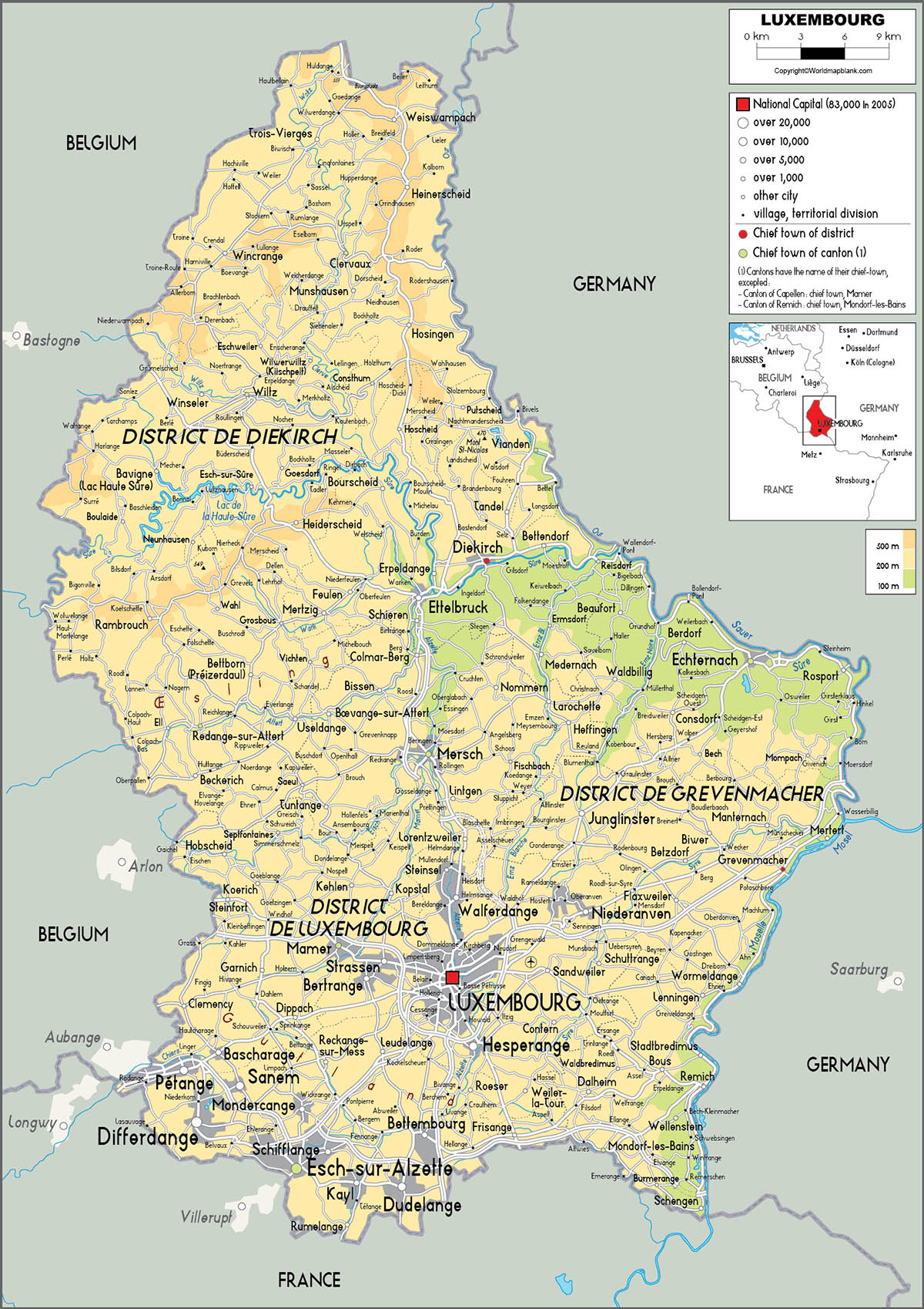
This population is 0.01% of the total global population. Luxembourg’s land area measured is equivalent to 2,586 square meters. The names of the major rivers that flow in the country include the Our, the Sûre, and the Moselle. All these rivers together form the border with Germany. With regard to religion observed in Luxembourg, the major religion is Catholicism, 63.8%. Other religions, include the Orthodox Church, Protestantism, Other Christians, Agnosticism, Atheism, Islam, and Buddhism.
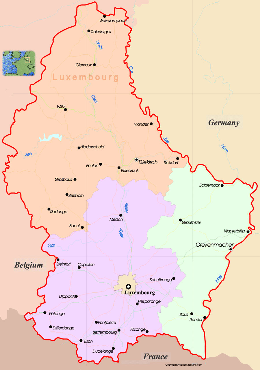
Labeled Map of Luxembourg with States
As a part of the labeled map of Luxembourg with States, there are total of twelve provinces or states in Luxembourg. Accordingly, the Grand Duchy of Luxembourg is divided into cantons through which municipalities are grouped. Out of this, a dozen of the municipalities is given the official status of a city. The City of Luxembourg is further categorized into quarters or they are declared as subdivisions, unofficially. The names of the province or state, include Capellen, Clervaux, Diekirch, Canton d’Echternach, Canton d’Esch-sur-Alzette, Grevenmacher, Mersch, Range, Remich, Vianden, and Wiltz.
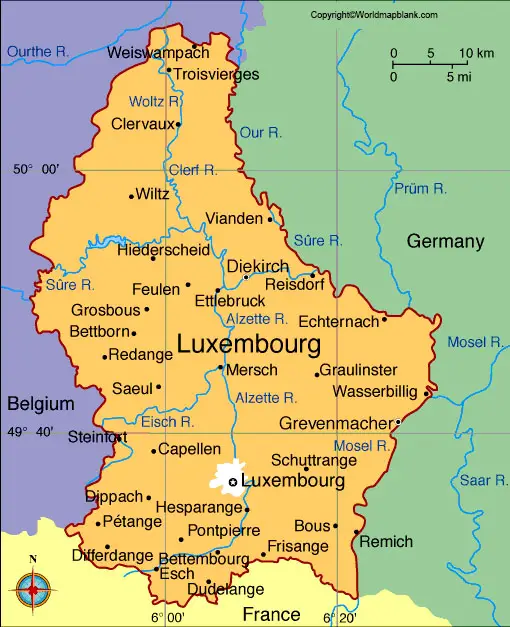
Labeled Map of Luxembourg with Cities
As a part of the labeled map of Luxembourg with cities or towns, the names of these major towns, include Vianden, Vianden, Grevenmacher, Rumelange, Echternach, Wiltz, Diekirch, Ettelbruck, Dudelange, Differdange, and Esch-sur-Alzette.
Labeled Luxembourg Map with Capital
The satellite view of labeled Luxembourg with capital shows that the national capital of the Grand Duchy of Luxembourg is recognized as Luxembourg City. This is situated at the confluence of rivers, like Pétrusse and Alzette in the southern part of Luxembourg country. It is possible to find several valleys and outcrops in Luxembourg City.
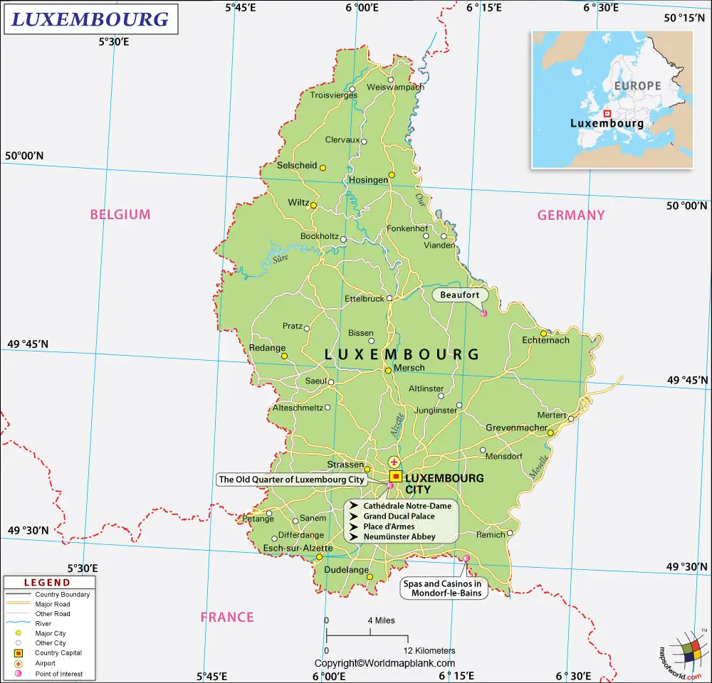
It is famous for its fortified medieval old town perched on sheer cliffs. The population of Luxembourg city is equivalent to about 100000 inhabitants today. The main attractions of the city, include the National Museum of History and Art, the only cathedral in the country known as, the Notre-Dame Cathedral, and Grand Ducal Palace. Another attraction of the city is the Mudam, which is the foremost museum dedicated to contemporary art in Luxembourg. It is also possible to find a public meeting place and cultural center known as, the Neumünster Abbey.
Related Posts


