Labeled Map of Malaysia with States, Capital & Cities
The Labeled Map of Malaysia shows that it is a country located in the south-eastern region of Asia. It consists of two parts, Peninsular Malaysia or West Malaysia, and Malaysian Borneo or East Malaysia. West Malaysia is situated on the Malay Peninsula whereas East Malaysia is on the northern part of the island of Borneo. In the east, South China, in the west, the Strait of Malacca, in the north, Thailand, and at its tip in the south, Singapore, are the borders of West Malaysia.
- World map with continents
- Physical world map
- Political world map
- Labeled map of Asia
- Labeled map of Africa
- Labeled map of Europe
- Labeled map of Antarctica
- Labeled map of South America
- World time zone map
- Labeled map of World
- World map with Latitude
- Blank map of world
- Labeled map of North America
- Blank map of Asia
- World map with oceans
- World map poster
Labeled Map of Malaysia
East Malaysia borders Indonesia in the south, the South China Sea in the northwest, and is surrounded by a small nation called Brunei. With the Philippines and Vietnam, Malaysia shares maritime borders. The total land area of this country is measured as 329,847 square kilometers or 127,350 square miles. In terms of area, Malaysia is considered as the sixty-sixth largest country on the globe.
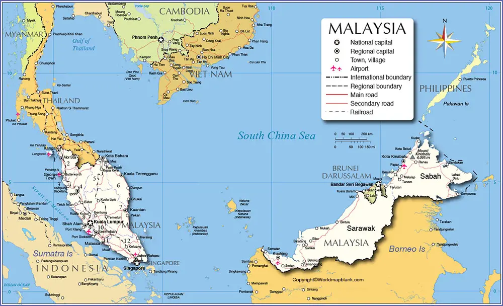
This area makes the country slightly larger than Norway or slightly larger than the US state of New Mexico. The current population of Malaysia is 32,426,641 people. Some of the long rivers that flow in the country, include Rajang, Kinabatangan, Pahang and Perak. The official religion followed in the country is Islam.
Labeled Map of Malaysia with States
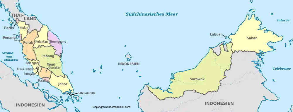
As a part of the labeled map of Malaysia with states, the country is divided into a federation of thirteen states or administrative regions. In West Malaysia, out of thirteen states, eleven states and two Federal Territories are situated in the Malay region. In East Malaysia, the remaining two states are situated on the island of Borneo.
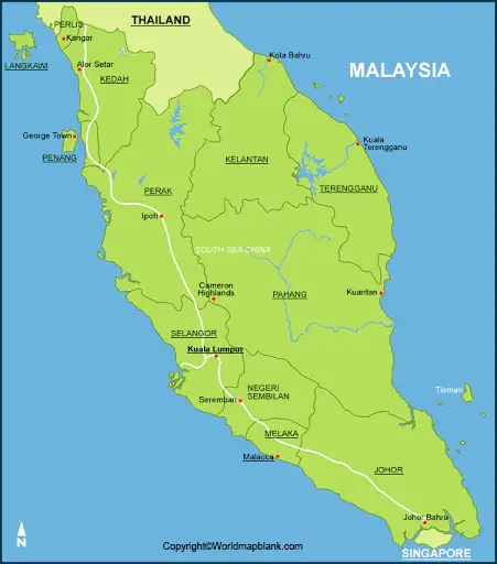
States located in West Malaysia, include Sultanate of Johor, Malacca, Elective Monarchy of Negeri Sembilan, Federal Territory of Putrajaya, Sultanate of Selangor, Sultanate of Pahang, Sultanate of Terengganu, Sultanate of Kelantan, Sultanate of Perak, Pulau Pinang, Sultanate of Kedah and Kingdom of Perlis. The Federal Territory of Kuala Lumpur is the legislative capital of the country. The two states in East Malaysia, on Borneo, are known as, Sarawak and Sabah.
Labeled Map of Malaysia with Cities
As a part of the labeled map of Malaysia with cities, some of the big cities, include Sandakan, Tawau, Alor Setar, Kuantan, Kota Kinabalu, Malacca City, Johor Bahru, Ipoh, George Town of Penang, and Kuala Lumpur.
Labeled Malaysia Map with Capital
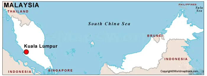
Through the labeled Malaysia with capital, it can be seen that the capital and the largest city of Malaysia is Kuala Lumpur. In the metro area, the population is 7,200,000 people. The city is recognized also as one of the Federal Territories of Malaysia. In the Klang Valley, at the point where the Gombak and Klang rivers converge, this city is located. The Parliament of Malaysia and the official residence of the King of Malaysia are the attractions of this city. It is the fastest-growing city in the Malaysian Peninsula with cultural, financial, and economic activities. It is one of the top tourist attractions on the globe.
Related Posts


