Labeled Map of North Korea with States, Capital & Cities
Through the Labeled Map of North Korea, one can understand that Korea is located in the East Asian region. It has been divided into two separate sovereign states, like South Korea and North Korea, since 1945. From then onwards, it continues to be known as South Korea or officially, the “Republic of Korea,” and North Korea or, the “Democratic People’s Republic of Korea.”
- World map with continents
- Physical world map
- Political world map
- Labeled map of Asia
- Labeled map of Africa
- Labeled map of Europe
- Labeled map of Antarctica
- Labeled map of South America
- World time zone map
- Labeled map of World
- World map with Latitude
- Blank map of world
- Labeled map of North America
- Blank map of Asia
- World map with oceans
- World map poster
The southern region of this Korean peninsula is occupied by South Korea, which extends to a distance of about 1,100 kilometers or 680 miles from the mainland of Asia. Being a mountainous peninsula, South Korea is bordered by the Yellow Sea to the west and the Sea of Japan to the east.
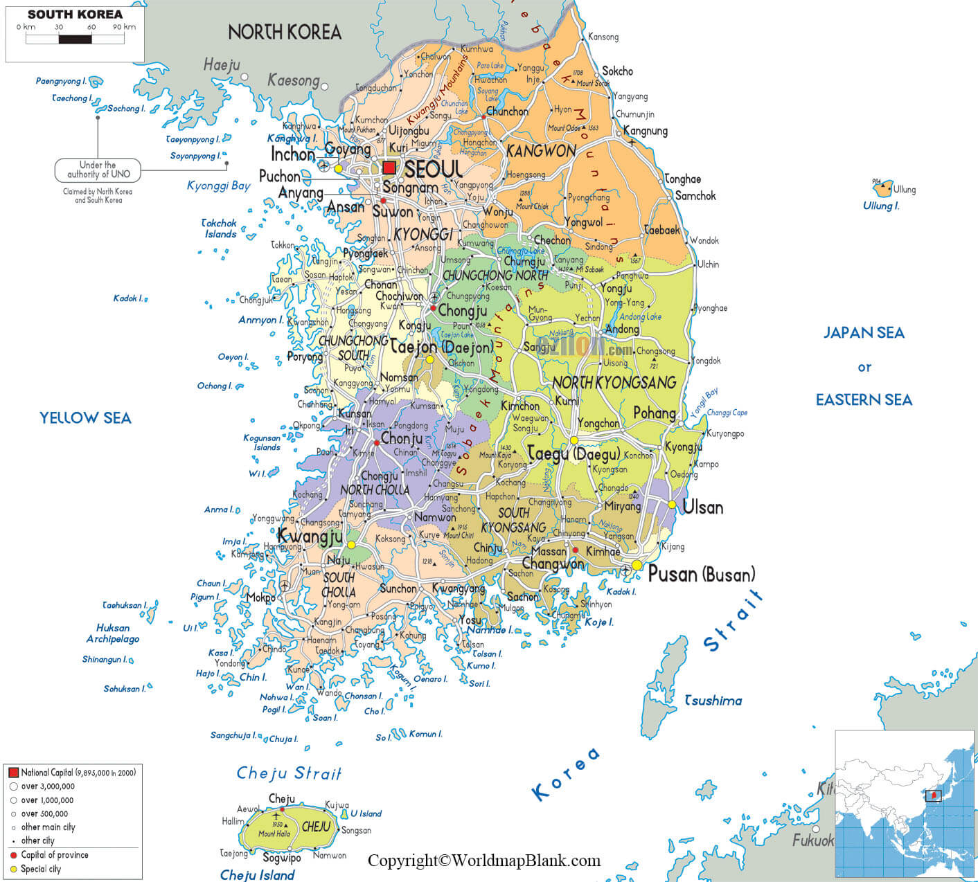
Labeled Map of North Korea
It shares a maritime border with Japan. The southern tip of South Korea lies on the Korean Strait and the China Sea in the East. Between North Korea and South Korea there is heavily militarized borders. It is said that North Korea is a country in the region of East Asia. It constitutes the northern portion of the Korean Peninsula.
The 2020 population of South Korea, stands at 51,269,185 people whereas the population of North Korea stands at 25,791,197 people. The entire landmass of the Korean peninsula covering both South and North Korea measures about 84,565 square miles.
Four major rivers flow in South Korea, namely the Han River, the Kum River, the Naktong River, and the Somjin River. The major rivers that flow in North Korea, include Yalu, Tumen, Taedong, and Bukhan. Major religions followed by South Koreans, include Christianity and Buddhism. The religion in North Korea primarily consists of Buddhism and Confucianism.
Labeled North Korea Map with States
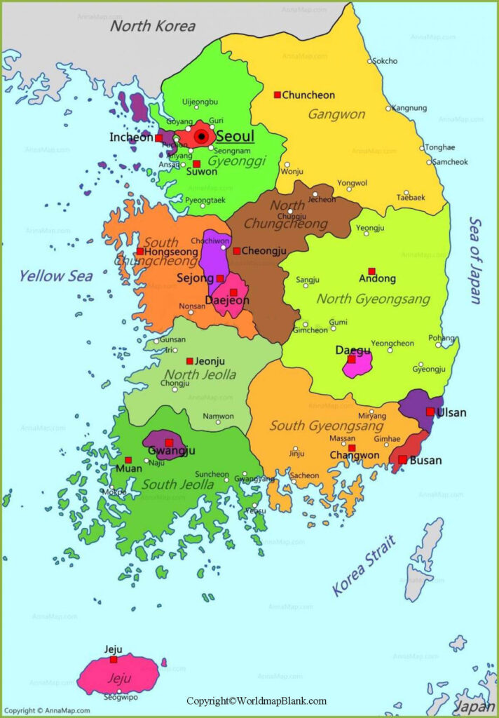
As a part of the labeled map of Korea with states or provinces, there are nine provinces in this country. The names, include Jeju Special Self-Governing Province, South and Jeolla, South and North Gyeongsang, Gyeonggi, Gangwon, North and South Chungcheong. Similarly, there are nine provinces or states in North Korea. They include Ryanggang, North and South Pyongan, Kangwon, North and South Hwanghae, North and South Hamgyong, and Changing.
Labeled Map of North Korea with Cities
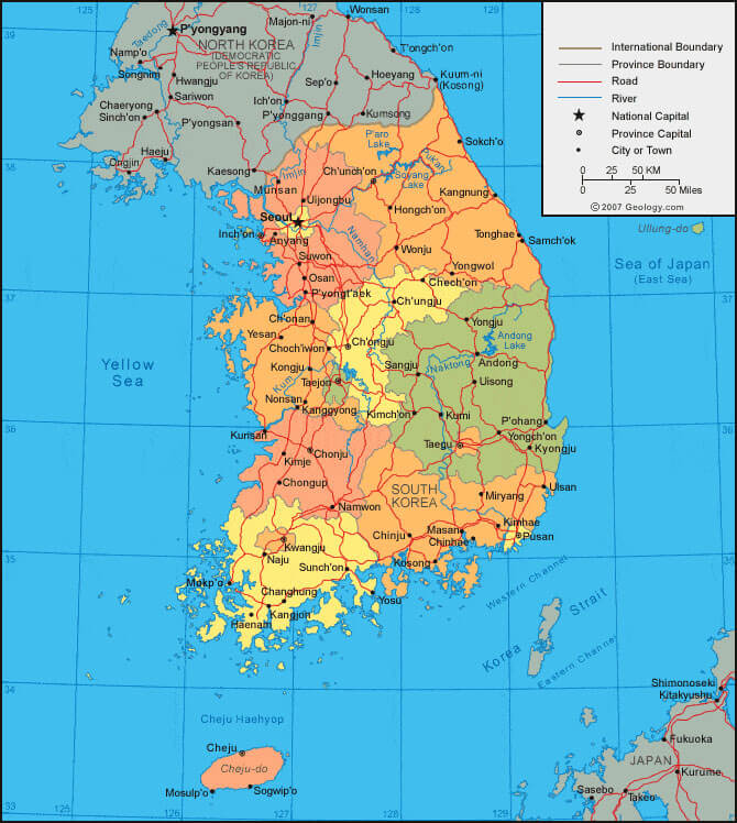
As a part of the labeled map of Korea with cities, the major and popular cities in South Korea, including Seoul, Busan, Incheon, and Daegu. There are twenty-eight cities, according to the official North Korean designation. Some of the names of the North Korean cities, include Nampo, Chongjin, Hamhung, and Pyongyang.
Labeled North Korea Map with Capitals
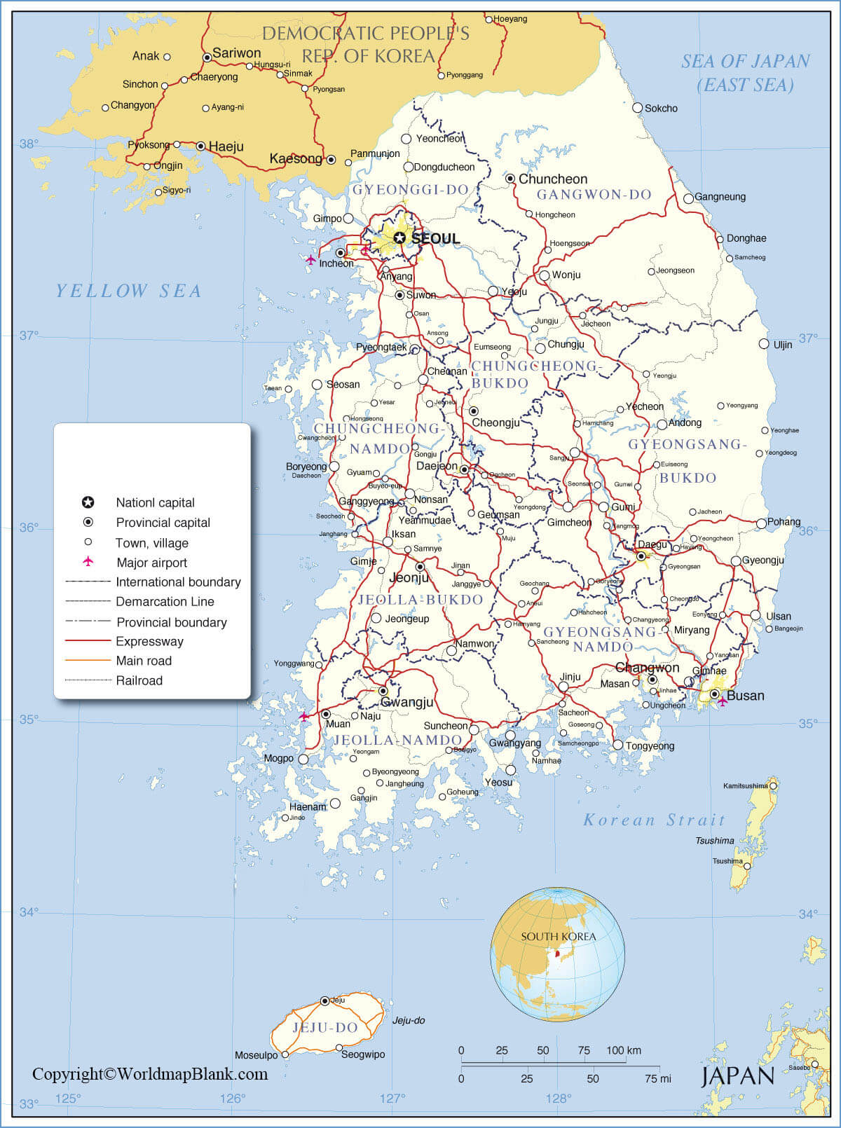
As a part of labeled Korea with capital, there are two capital cities. Seoul is recognized as the capital city of South Korea whereas Pyongyang is the capital city of North Korea. Seoul has been designated as the official capital of South Korea.Korea is the cultural center of the country.
Related Posts


