Labeled Map of Armenia with States, Capital & Cities
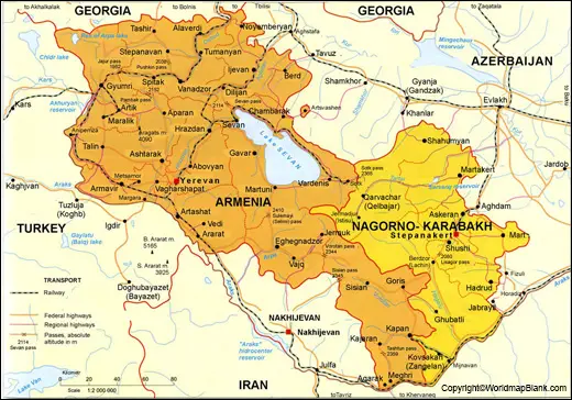
The Armenia Labeled Map shows that the country is bordered on the north by Georgia. On the eastern side, it is bordered with Azerbaijan, in the southwest, by Nagorno-Karabagh, in the south by Iran, and in the west, Armenia is bordered by Turkey. It is a landlocked mountainous country located in southeastern Europe/western Asia. The total area of the country measures 29,743 km².
- World map with continents
- Physical world map
- Political world map
- Labeled map of Asia
- Labeled map of Africa
- Labeled map of Europe
- Labeled map of Antarctica
- Labeled map of South America
- World time zone map
- Labeled map of World
- World map with Latitude
- Blank map of world
- Labeled map of North America
- Blank map of Asia
- World map with oceans
- World map poster
Through the area, it may be seen that Armenia is found to be slightly smaller than Belgium or even slightly smaller than the state of Maryland in the US. Based on the Worldometer elaboration of the latest United Nations data, the latest updates on the population of Armenia is recorded. Accordingly, as on June 4, Thursday 2020, the population figures in the country of Armenia read as 2,962,846.
Labeled Map of Armenia
This population is found to be equivalent to 0.04% of the total global population. Mainly fresh water flows in the rivers of Armenia. Several rivers flow in this country. Araks is the largest river that flows in the Republic of Armenia.
This flows on the border of the country with Iran and a large portion of the border with Turkey. Debed and Aghstev are the other largest rivers that flow in the northwestern region of the country. The main religion followed is Christianity. About 94.8 percent of Armenian people are the members of the church of Armenia and Apostolic church of Armenia.
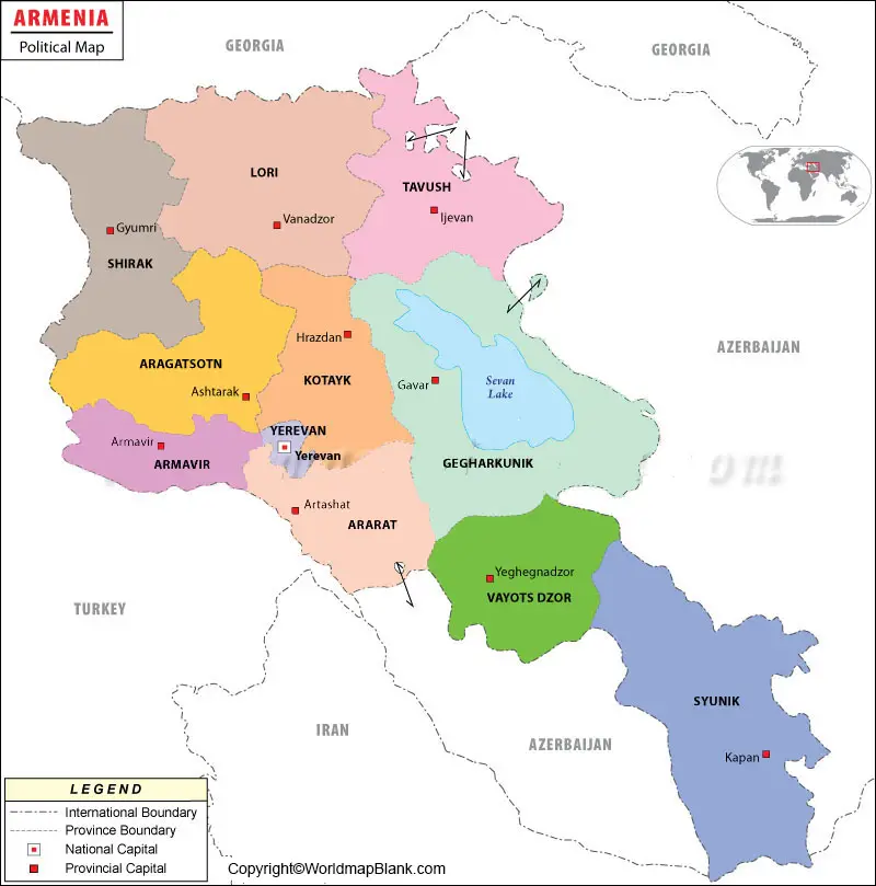
Labeled Map of Armenia with States
Labeled Map of Armenia with States shows that the country is subdivided into eleven administrative divisions. Out of this, ten of them are provinces or states, known as, marzer. The province named, Yerevan, is recognized as a separate state granted with special administrative status.
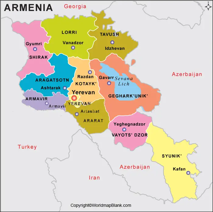
Yerevan is the capital city of the country. The names of the subdivisions, include Aragatsotn, Ararat, Armavir, Gegharkunik, Kotayk, Lori, Shirak, Syunik, Tavush, Vayots Dzor and Yerevan.
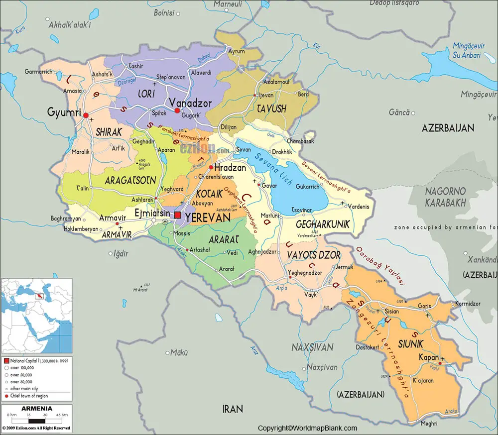
Labeled Map of Armenia with Cities
The labeled map of Armenia with cities depicts a number of cities. They include Yerevan, Yeghegnadzor, Vanadzor, Tashir, T’alin. Similarly, there are thirty-seven cities found in the country.
Labeled Armenia with Capital
According to labeled Armenia with Capital, the largest and the capital city of Armenia is Yerevan. It is one of the oldest and continuously inhabited cities in the world as well. The city is located on the banks of Hrazdan River; it is recognized as the industrial, cultural, and administrative center of the country. The role of Yerevan, as the capital city Armenia, is its enormous growth in the economy.
The city has continuously transformed into a great business hub involving new constructions, rapid growth in retail outlet business, street cafes, restaurants, malls, tall buildings, and commercial establishments.
The notable landmarks in this capital city of Armenia, include Fortress of Erebuni. This place is known as the official memorial to the Armenian Holocaust’s victims and is a well-known tourist spot for the tourists. In 2012, the city of Yerevan was named as the World Book Capital by UNESCO.
Related Posts


