Labeled India Map with States, Capital and Cities
Officially designated as the Republic of India, Labeled India Map depicts India as the most popular country situated in South Asia. India is surrounded by the Bay of Bengal in the east, the Arabian Sea in the west, and the Indian Ocean in the South. Countries like Pakistan, Nepal, China, Myanmar, Bhutan, and Bangladesh occupy the border limits of India.
- World map with continents
- Physical world map
- Political world map
- Labeled map of Asia
- Labeled map of Africa
- Labeled map of Europe
- Labeled map of Antarctica
- Labeled map of South America
- World time zone map
- Labeled map of World
- World map with Latitude
- Blank map of world
- Labeled map of North America
- Blank map of Asia
- World map with oceans
- World map poster
Similarly, countries like Maldives, Indonesia, Sri Lanka, and Thailand, share maritime borders of India. The distance measured from the southern coastline to the northern border is 2930 km or 1,820 miles. The distance from the west coast of Gujarat to the border with Bangladesh in the east is 2,040 km or 1,267 miles.
Labeled India Map
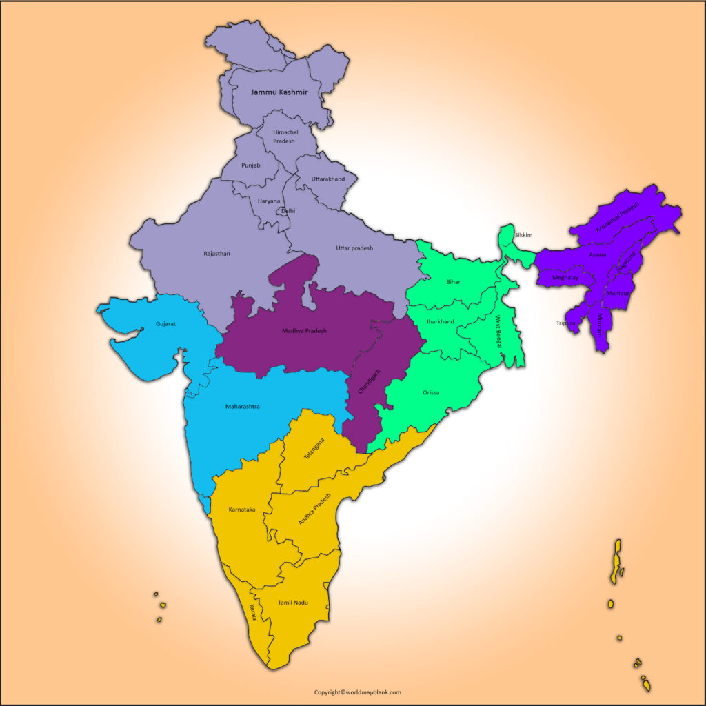
The total area covered by India is 3,287,263 km². It is considered as the seventh-largest country on the globe. While comparing the size of India with countries like Australia, USA, Europe, it may be seen that the size of India is about forty-five per cent the size of Australia, about the forty-percent size of the USA, or about 33% the size of Europe.
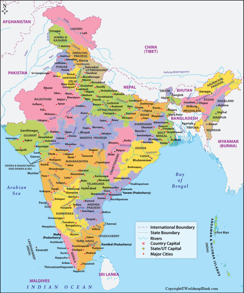
On the planet, the second most populated country is India. The total population of India is equivalent to 1.36 billion people. Some of the important Himalayan rivers in India are: the Brahmaputra, Yamuna, Ganga and Indus. Cauvery, Krishna, Godavari and Mahanadi are main Peninsular rivers. Some of the major religions in India are: Hinduism, Islam, Buddhism, Christianity, Jainism and others.
Labeled Map of India with States
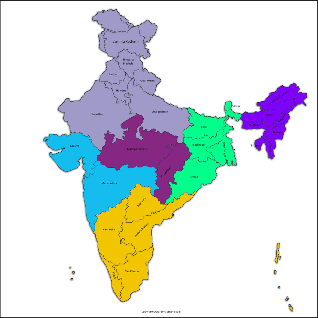
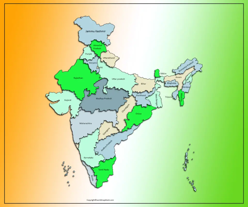
In the labeled map of India with States, it may be seen that India is considered as the union of twenty-eight states and nine union territories. The central government of India directly rules union territories while states are ruled by their own elected governments.
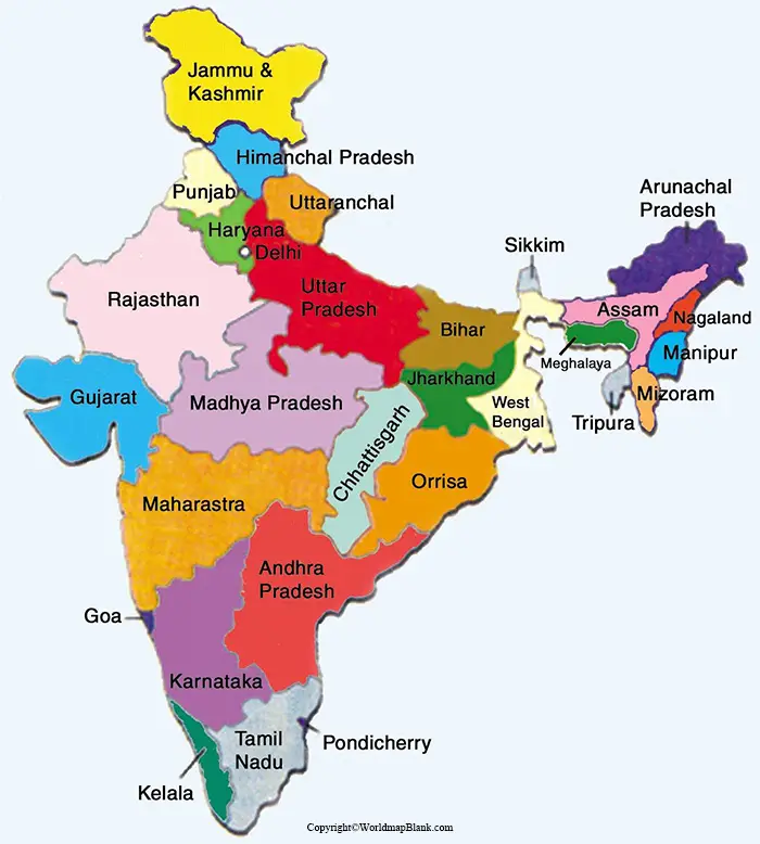
The names of the states in their alphabetical order include Andhra Pradesh, Arunachal Pradesh, Assam, Bihar, Chhattisgarh, Goa, Gujarat, Haryana, Himachal Pradesh, Jharkhand, Karnataka, Kerala, Madya Pradesh, Maharashtra, Manipur, Meghalaya, Mizoram, Nagaland, Odisha, Punjab, Rajasthan, Sikkim, Tamilnadu, Telangana, Tripura, Uttar Pradesh, Uttarakhand, and West Bengal. The names of the nine union territories of India, include Andaman & Nicobar Islands, Chandigarh, Dadra Nagar Haveli and Diu Daman, Delhi, Jammu & Kashmir, Ladakh and Lakshadweep.
Labeled Map of India with Cities
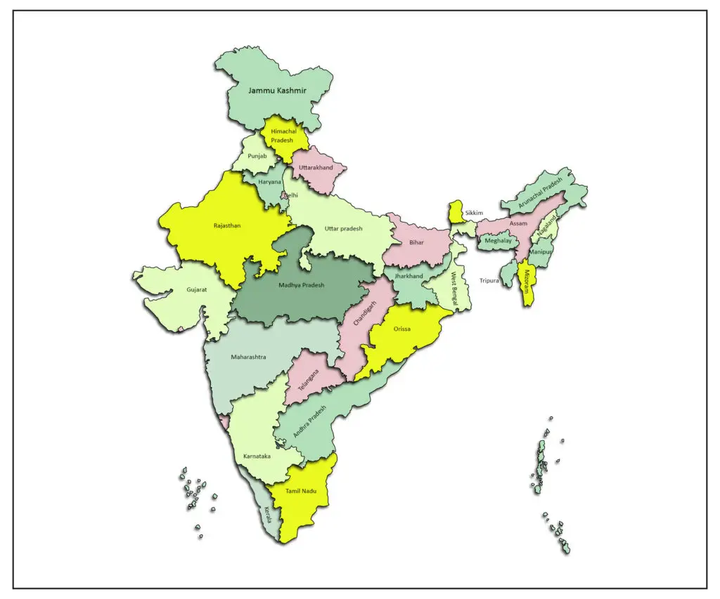
The labeled map of India with cities reveals that India has approximately three hundred cities. However, in rural areas, the major portion of the populace lives. In North India, the largest city in population and area in Delhi. The wealthiest city in India is Mumbai. This is also considered the financial capital.
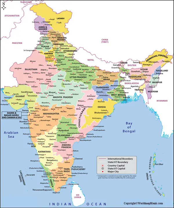
As regards South India, Bengaluru, earlier called Bangalore, and Chennai, which was formerly known as Madras, are the largest cities.
Labeled India Map with Capital
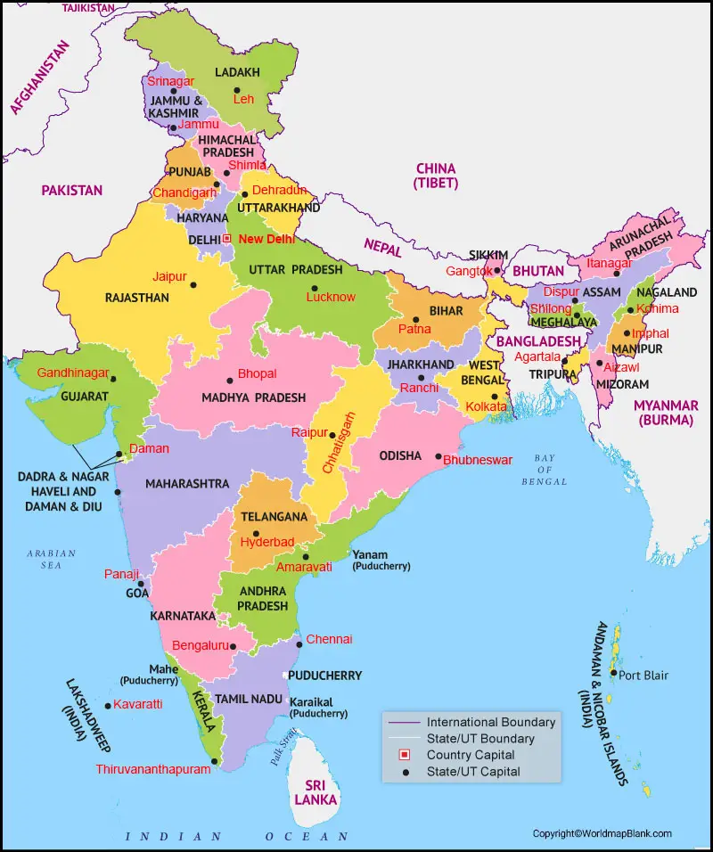
Labeled India with capital is Delhi. This is situated on the banks of the Yamuna river. States like Haryana and Uttar Pradesh border this city. The largest commercial center is regarded to be Delhi. True Indian culture can be found in Delhi as it depicts the amalgamation of traditional as well as modern cultures.
Checkout for Blank Map of India

