Blank Map of Colombia – Colombia Outline Map [PDF]
This page features not one blank map of Colombia but six! Each is carefully constructed using a layered approach to learning about a country. For example, the Colombia outline map is a blank map with the country’s outer borders. This is ideal for drawing in features.
All of the maps are available in A4 and A5 in PDF format. You can download or print the maps for free directly from your browser. So, please take a moment and look through our blank maps of Colombia collection!
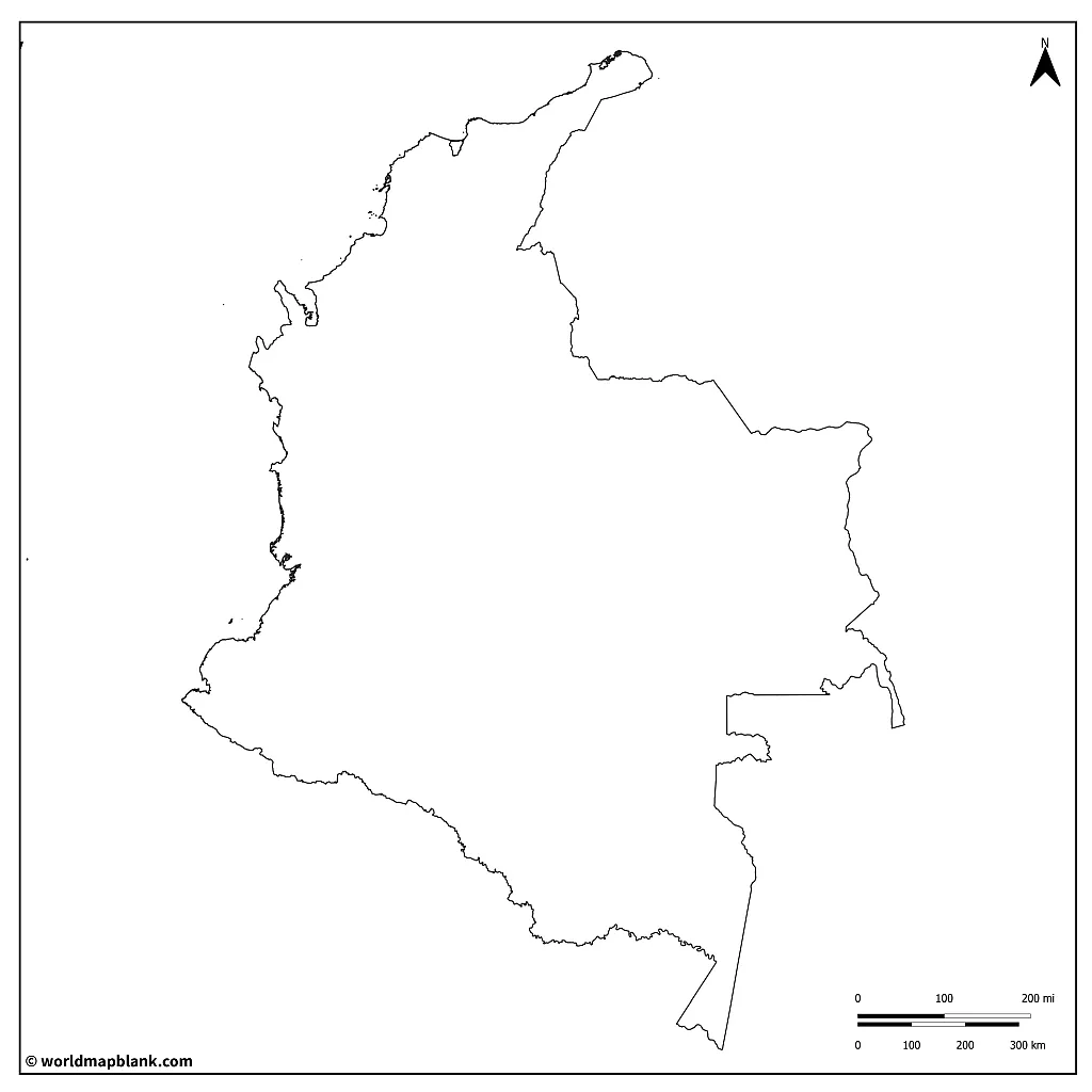
Outline Map of Colombia
Colombia, named after the Italian explorer Christopher Columbus, is a country in South America. It has a population of approx. 52 million, and covers an area of 440,831 square miles (1,141,748 km2). Its history as a colony of Spain greatly influenced its culture and identity today. Roughly 87.5% of the population is classified as “non-ethnic”, or of mixed European and Amerindian ancestry. The indigenous Amerindians today make up only 4.3% of the population.
Download as PDF (A4)
Download as PDF (A5)
In general, the climate of Colombia is considered tropical. However, it varies from region to region. Colombia has six distinct natural regions:
- The Andes mountain range region with high altitudes and varied topography, including deep valleys, plateaus, and snow-capped peaks. The climate ranges from cold to mild, as it is influenced by altitude.
- The Pacific Coastal region has dense rainforests and warm temperatures due to its proximity to the equator. The region receives high levels of rainfall throughout the year and is prone to flooding. The coastal area is dotted with mangrove swamps and has a large number of estuaries and bays.
- The Caribbean coastal region features white sandy beaches, coral reefs, and numerous islands. The region has a tropical climate, with high temperatures and humidity throughout the year. It’s also prone to hurricanes and heavy rainfall, particularly between May and November.
- The Llanos, or plains, are open grasslands and wetlands with hot and humid weather. The region has two distinct seasons: a rainy season from May to November and a dry season from December to April.
- The Amazon rainforest region is covered by dense tropical rainforests and is home to numerous rivers, including the Amazon River. This region has a hot and humid climate with abundant yearly rainfall.
- The insular areas in the Atlantic and Pacific oceans. These islands have a range of climates and geographies, some featuring tropical rainforests while others are arid and desert-like.
Interesting fact: Colombia experiences volcanic activity in the Andes mountain region. It is considered part of the “Ring of Fire”, designated areas of the world that are affected by earthquakes and volcanic eruptions.
Activity idea: Can you identify and shade these regions in different colors? How about drawing in geographic features that represent each region?
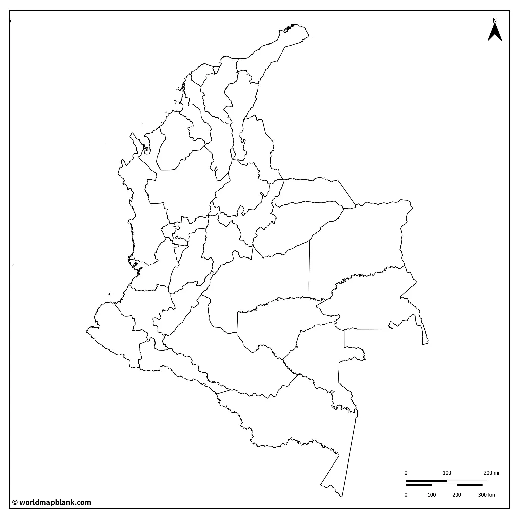
Colombia Blank Map
Colombia is a participatory democratic country with a president elected by the people. Similar to the system of the United States of America, their president holds a 4-year term in office.
The country is divided into 32 administrative departments and the capital district, Bogotá. Each of these departments is further split into municipalities to be governed by local officials elected for four years. Besides Bogota, 4 cities have been appointed districts due to their unique characteristics: Barranquilla, Cartagena, Santa Marta, and Buenaventura.
Download as PDF (A4)
Download as PDF (A5)
Colombia is a country that is rich in natural resources. It has minerals, fuel, oil, agricultural products, and precious stones. Not only does Colombia have a great wealth in raw materials, but it is also a very industrious country. The nation produces anything from construction equipment to military supplies, prefabricated buildings, software, shoes, cosmetics, pharmaceuticals, and more. Colombia’s principal trade partners are the United States, the European Union, and China.
Activity idea: Can you research in which province there are specific industries? Each province, due to its geographic position and the area’s natural resources, has developed its economy around what it has available. Make a legend and color code the provinces according to their industry!
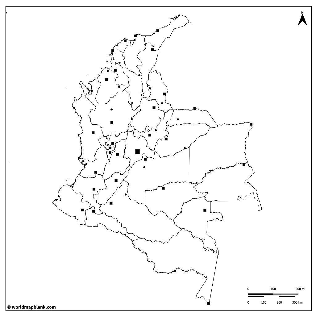
Blank Colombia Map with Capitals
Bogotá is the capital city of the country of Colombia. It is also the capital of the department of Cundinamarca. It has been classified as the Capital District, with equal power to a department. Apart from Bogotá, four other cities have likewise been designated special districts. Barranquilla, Buenaventura, Cartagena, and Santa Marta are considered notable municipalities.

Download as PDF (A4)
Download as PDF (A5)
The above map is excellent for learning about the country’s administrative divisions.
Here is a list of the capitals of the departments of Colombia in alphabetical order, along with their respective departments:
- Armenia, Quindío Barranquilla – Atlántico – 1,232,000
- Bogotá, Distrito Capital – 7,878,000
- Bucaramanga, Santander – 580,000
- Buenaventura, Valle del Cauca – 412,000
- Cali, Valle del Cauca – 2,239,000
- Cartagena, Bolívar – 914,000
- Cúcuta, Norte de Santander – 764,000
- Florencia, Caquetá – 177,000
- Ibagué, Tolima – 539,000
- Inírida, Guainía – 28,000
- Leticia, Amazonas – 47,000
- Manizales, Caldas – 418,000
- Medellín, Antioquia – 2,476,000
- Mitú, Vaupés – 19,000
- Mocoa, Putumayo – 48,000
- Montería, Córdoba – 333,000
- Neiva, Huila – 361,000
- Pasto, Nariño – 418,000
- Pereira, Risaralda – 482,000
- Popayán, Cauca – 295,000
- Puerto Carreño, Vichada – 18,000
- Puerto Inírida, Guainía – 28,000
- Quibdó, Chocó – 139,000
- Riohacha, La Guajira – 212,000
- San Andrés, San Andrés y Providencia – 64,000
- San José del Guaviare, Guaviare – 41,000
- Santa Marta, Magdalena – 465,000
- Sincelejo, Sucre – 262,000
- Tunja, Boyacá – 195,000
- Valledupar, Cesar – 454,000
- Villavicencio, Meta – 538,000
- Yopal, Casanare – 162,000
Activity idea: Use this blank map of Colombia to color the departments according to their population density.
Extra challenge: Can you research and find out which departments have administrative collaborations because of low populations?
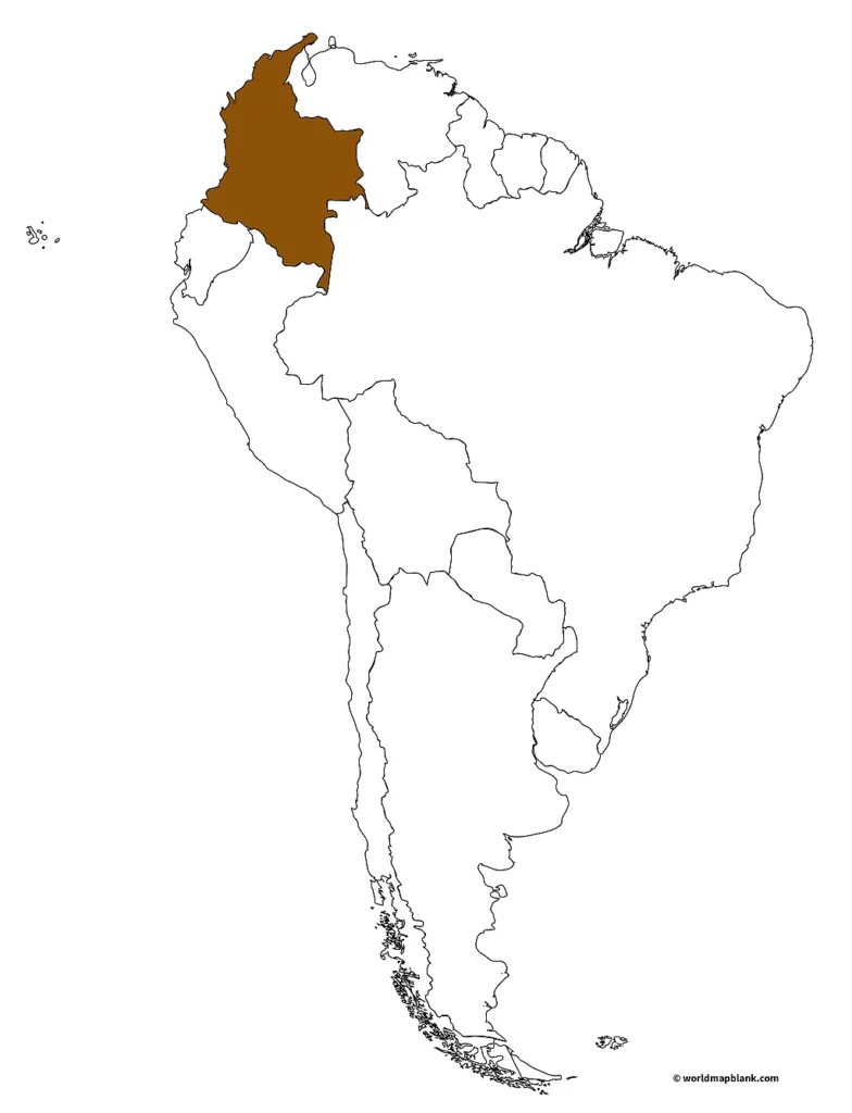
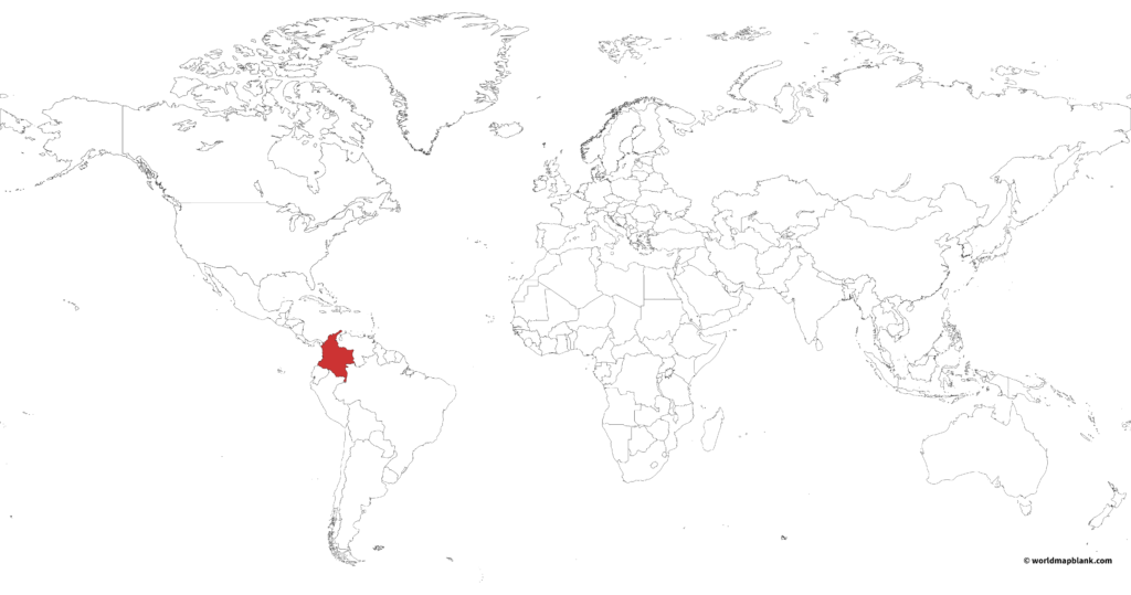
Where is Colombia on a Map?
Where is Colombia located on a map? Colombia is classified as part of both the western and northern hemispheres. Curiously, it is considered part of the northern hemisphere as it belongs to South America. Colombia is situated at the northwestern tip of the South American continent. The reason for this lies in its physical location in relation to the Equator. It is near the equator at latitude 4.57° N and longitude 74.29° W.
The country has only one time zone observed all year round: Colombia Standard Time, also known as “GMT-5” (Greenwich Mean Time minus 5 hours).
Download as PDF (A4)
Download as PDF (A5)
The above map was created with MapChart, showing Colombia on a map of South America. If you would like a greater scale of perspective, here is another MapChart version with Colombia on a world map:
Download as PDF (A4)
Download as PDF (A5)
Activity Idea: Use any of these two maps to teach about Colombia in the greater context of the region or the world. Label the neighboring countries and shade each in a different color.
Colombia Map Outline with Cities
Once a more rural, agricultural society, the Colombians have slowly been migrating towards the cities. Where there are opportunities to work, the people go. Today, more than 77% of the population is living in urban areas.
Here’s a list of the top ten most populated cities in Colombia, in order from largest to smallest, along with their population rounded to the nearest thousand:
- Bogotá – 7,594,000
- Medellín – 2,485,000
- Cali – 2,235,000
- Barranquilla – 1,275,000
- Cartagena – 1,006,000
- Cúcuta – 766,000
- Bucaramanga – 539,000
- Pereira – 462,000
- Santa Marta – 447,000
- Ibagué – 432,000
Interesting facts: Each city mentioned above is famous for a reason, here is a short list that corresponds with the cities mentioned above and can be used for the following activity.
- Bogota is the capital and largest city of Colombia.
- Medellín is the hometown of artist Fernando Botero.
- Cali has salsa music, a dance scene, and colonial architecture.
- Barranquilla hosts one of the largest Carnivals in the world.
- Cartagena is a UNESCO World Heritage Site.
- Cúcuta is a border city with Venezuela and a major commercial hub.
- Bucaramanga has a coffee culture and is a center of higher education.
- Pereira has coffee production and is a technology and innovation center.
- Santa Marta has beaches beautiful nature, and is the starting point of the Lost City.
- Ibagué is the origin of a genre of music called “Tolima Grande.”
Download as PDF (A4)
Download as PDF (A5)
Activity Idea: Can you find out something interesting about each city? First, find and label the cities. Next, refer to the above list and create a personalized map by drawing a symbol that characterizes each city! For example, Bogotá is the capital; it can be marked with a star.
Blank Map of Colombia
Colombia is a country that has been externally influenced since Christopher Columbus first visited it. This is reflected in its population’s genealogy and society’s development. Geographically, it stands in a strategic position, with port cities and access to the Pacific Ocean and the Caribbean. At the northern tip of South America, it is also reasonably within reach for all the Americas. It is a country that belongs to many international organizations, from trade alliances to military agreements to the UN.
Download as PDF (A4)
Download as PDF (A5)
The above map details which countries border Colombia.
Colombia shares five land borders with other countries. Brazil to the southeast, Venezuela to the east, Peru to the south, Ecuador to the southwest, and Panama to the northwest. As mentioned above, it has a coastline on the Caribbean Sea to the north and the Pacific Ocean to the west.
Activity idea: Can you label all the neighboring countries and bodies of water?
Extra challenge: Identify the countries Colombia shares maritime borders with. Maritime borders are when you have a coastline with a body of water, and so do other countries, in effect, your jurisdictions touch through the water.
More Free Maps for Download
If you want to learn more about South American countries or the continent, look no further! A list of links below directly leads you to exciting resources. Likewise, there are many other map pages to look through! From our home page, the maps are organized into several categories, such as world maps, blank maps, and labeled maps.
If we don’t have what you are looking for, drop us a line! We are constantly updating and improving our map collections. We might even create a particular map just for you – free of charge!
South America Maps
- Blank Map of South America
- Political Map of South America
- Blank Map of Argentina
- Argentina Map with Provinces
- Outline Map of Brazil
World Maps
- Political World Map
- World Map with Oceans and Seas
- Blank World Map
- World Map with Continents
- World Map for Kids
Other Continent Maps
- Blank Map of Africa
- Political Map of Africa
- Blank Map of Europe
- Political Map of Europe
- Blank Map of Asia
- Political Map of Asia
- Blank Map of Australia
- Political Map of Australia
Other Country Maps
Related Posts


