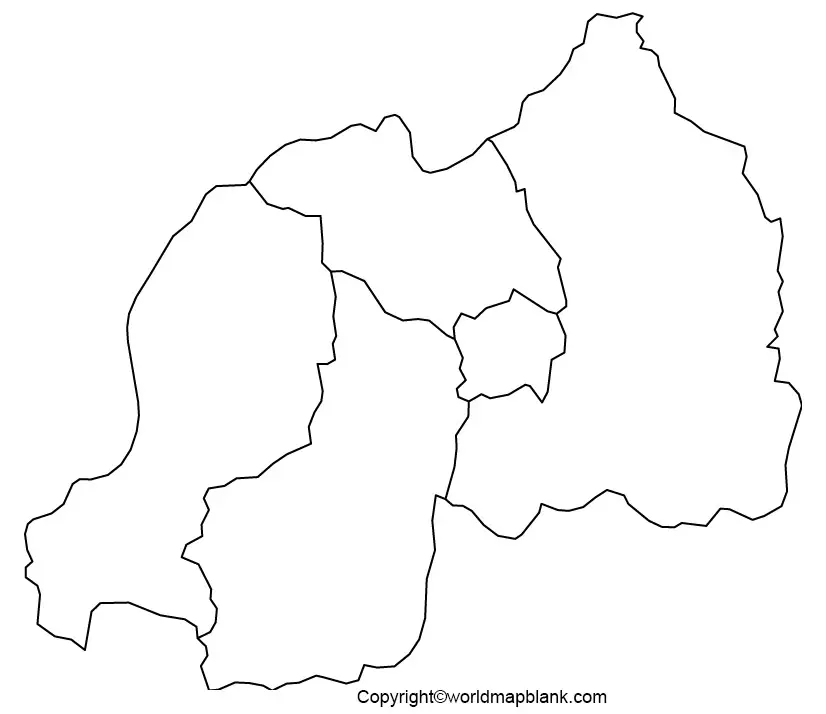
Printable Blank Map of Rwanda – Outline, Transparent, PNG map
The student or any user can get the Blank Map of Rwanda and make himself aware of the geographical characteristics of the country. By viewing this map, the student will be able to draw the map of Rwanda, accurately. Rwanda is a small landlocked country situated in the region of Central Africa. It is located in the South of Equator and to the east of Lake Kivu, which is one of the African Great Lakes. It has borders with Burundi, Uganda, Tanzania, and the Democratic Republic of Congo. The capital city of Rwanda is Kigali, which is the largest city in the country with an estimated population of one million people.
- Blank Map of Nicaragua
- Blank Map of Grenada
- Blank Map of Greece
- Blank Map of Ghana
- Blank Map of Canada
- Blank Map of Armenia
- World map with continents
- Physical world map
- Blank Map of Egypt
- Political world map
- Blank Map of Fiji
- World map poster
- World time zone map
- Blank Map of Ethiopia
- Labeled map of World
- Blank Map of Sudan
- World map with longitude and latitude
- Blank Map of Armenia
- Blank map of world labeled map of Asia
- Labeled map of Africa
- Blank Map of Finland
- Labeled map of Europe
- World map with oceans
- Labeled map of antarctica
- Blank Map of Azerbaijan
- Labeled map of south america
- Labeled map of North America
- Blank map of Asia
- Blank Map of France
- Blank Map of Georgia
- Blank Map of Czechia
- Blank Map of Germany
- Blank Map of Colombia
- Blank Map of Cyprus
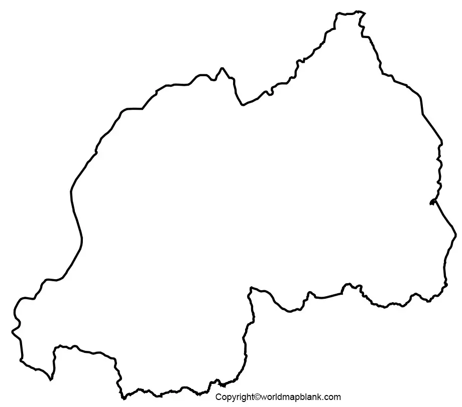
Blank Map of Rwanda – Outline
The official spoken language is Kinyarwanda, and other languages, include French, English and Swahili. The major economic activity of Rwanda is agriculture, which directly provides employment for sixty-percent of its total population. However, more than eighty percent of the population lives on survival agriculture. The country produces agricultural products, like coffee, tea, pyrethrum, bananas, beans, sorghum, potatoes and livestock. Industrial production includes cement, products of agriculture and other items. The country exports commodities like tin ore, hides, and coffee.
If the user is looking for more details on geographical insight of Rwanda, then he or she should view various types of printable blank map template of the country. Rwanda blank map outline is helpful to any user planning to draw the map of Rwanda for the first time. But he or she would certainly find it difficult to draw the map accurately since it is not an easy task. From this template, user can visualize the outer structure of Rwanda’s boundaries, which could guide in drawing the overall shape of the country.
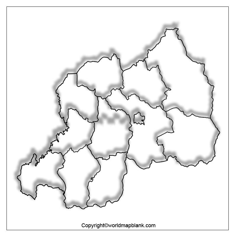
Printable Map of Rwanda
If the user is seeking a quick geographical view of Rwanda without drawing the map of the country or purchasing it from the market, then he or she can download it from the web. This being a printable map, is an effortless one, as the user need not have to make any additional effort on its preparation, because it is readily available.
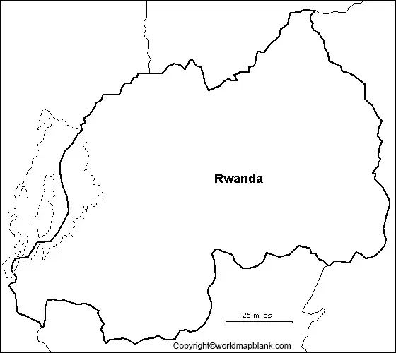
Transparent PNG Rwanda Map
If the user intends to gain an in-depth knowledge of the geography of Rwanda and have a detailed view of the objects of the country, then he or she should refer to a transparent PNG Rwanda available from the web. Such a map is completely transparent, which means that the user can have an inside view of small islands of the country or the plain land surface, including mountains.
Map of Rwanda for Practice Worksheet
If the user is confident about his or her geographical knowledge about Rwanda, then he or she should have to test or enhance the knowledge by working on the map of Rwanda for the practice worksheet. This worksheet comprises some questions with regard to the geographical characteristics of the country that can be answered by the user. Such a worksheet is available on the web, which can be printed and used whenever it is needed.
Related Posts


