Blank Map of China – Printable China Outline Map [PDF]
If you need a blank map of China for educational, professional, or personal purposes, you’re in the right place. We offer a variety of China outline maps in PDF format, available in both A4 and A5 sizes. These maps are valuable tools for educators, students, travelers, and anyone interested in exploring China’s geography, culture, and history.
On this page, we provide several printable China blank maps accompanied by helpful information about China’s geography, culture, and more. We also include name lists for the province and city markers in the maps, which can serve as answer keys for your learning activities.
If you are interested in ready-made teaching resources about the provinces and cities of China, please see our China map worksheets. Additionally, we offer various versions of a labeled map of China.
We hope our China blank maps will be informative and helpful. To download them in PDF format, simply click on the links under each map image. Get your free printable China outline map now!
China Outline Map
Our first China outline map shows the country’s boundaries, making it an ideal resource for educational purposes. Whether you’re a teacher looking for materials to use in your classroom or a student studying China’s geography, this map provides a clean and clear canvas to work with.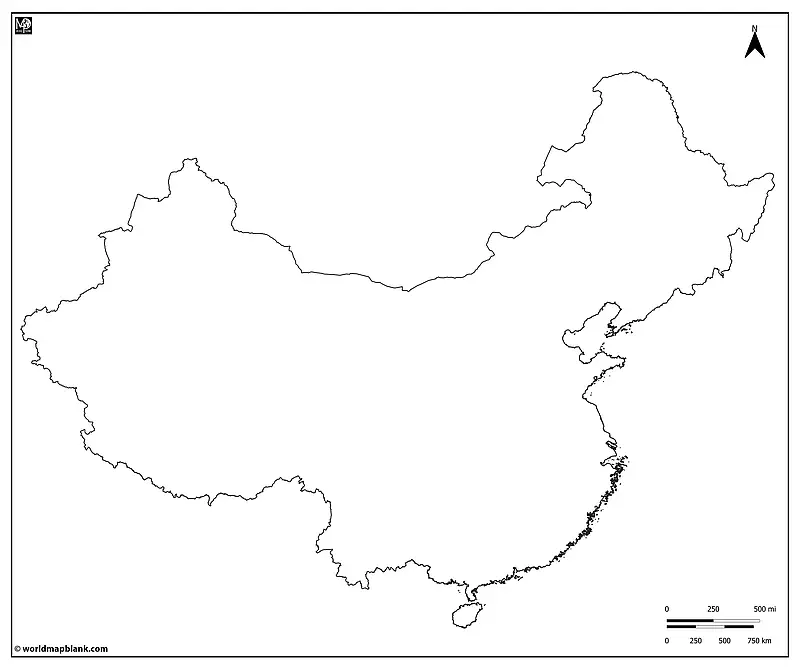
Download as PDF (A4)
Download as PDF (A5)
This map can be used for classroom activities and assignments such as drawing and marking exercises. For instance, students could mark rivers, mountain ranges, or other geographic features on the map. After that, the map can serve as a base for discussing China’s diverse geography and climate.
You could also use our China outline map to compare the territory of today’s China with that of its predecessors or early China. Alternatively, you might include it in geography quizzes, tests, or educational presentations. Finally, it can serve as a personal reference for your travels or in professional documents.
China: A Land of Diversity
China, officially known as the People’s Republic of China, is the second most populous country in the world, with a population of over 1.4 billion people. Located in East Asia, it covers an area of approximately 9.6 million square kilometers, making it the third-largest country by land area. China shares its borders with 14 neighboring countries, including India, Russia, and Vietnam, and it has a vast coastline along the East China Sea, South China Sea, and Yellow Sea.
China is a diverse and culturally rich nation with a long and complex history. The country is home to numerous ethnic groups, with the Han Chinese being the largest, comprising over 90% of the population. Other significant ethnic groups include the Zhuang, Hui, Uighur, and Tibetan peoples, each with distinct cultures, languages, and traditions.
Religiously, China exhibits a blend of beliefs, including Buddhism, Taoism, Islam, Christianity, and traditional Chinese folk religions. The country’s vast cultural heritage encompasses ancient philosophies like Confucianism and Taoism, traditional Chinese medicine, martial arts, and various culinary traditions.
The Geography of China
China’s geography is incredibly diverse, ranging from towering mountain ranges like the Himalayas and the Kunlun Mountains to expansive plateaus like the Tibetan Plateau. The country is also home to the world’s third-longest river, the Yangtze River, and numerous other major water bodies, such as the Yellow River and the Pearl River.
One unique geographical feature is the Great Wall of China, a historic fortification that stretches across northern China. This iconic structure is a testament to China’s rich history. Other key historical and geographical points of interest include the Terracotta Army in Shaanxi Province, the Potala Palace in Tibet, the bustling metropolis of Shanghai, the historic Forbidden City in Beijing, and the picturesque landscapes of Guilin, Guangxi.
Blank Map of China with Provinces
The following map is a blank map of China featuring the country’s provinces, autonomous regions, and municipalities and their boundaries. This map allows you to explore China’s administrative regions and is particularly useful for those studying Chinese geography or planning trips within the country.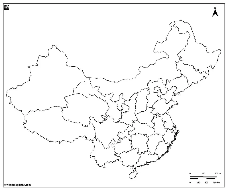
Download as PDF (A4)
Download as PDF (A5)
Possible uses of the above map include learning activities about China’s administrative divisions and creating educational materials for students. As a teacher, you could organize a classroom activity where students research and present information about specific Chinese provinces. Or you could plan a virtual journey across China, exploring each region’s unique characteristics.
Finally, you can use our blank map of China with provinces professionally to mark a company’s presence in different regions. Also, this map can be used in geographic research projects or for tracking trips and itineraries through China. Shading provinces in different colors is great for showing cultural characteristics, languages, populations, etc.
China’s Provinces, Autonomous Regions, and Municipalities
China is divided into 23 provinces (22 without Taiwan), 5 autonomous regions, 4 direct-controlled municipalities, and 2 Special Administrative Regions (SARs). These are:
Provinces (including Taiwan)
Anhui, Fujian, Gansu, Guangdong, Guizhou, Hainan, Hebei, Heilongjiang, Henan, Hubei, Hunan, Jiangsu, Jiangxi, Jilin, Liaoning, Qinghai, Shaanxi, Shandong, Shanxi, Sichuan, Taiwan (Note: Taiwan is self-governed and claims sovereignty), Yunnan, Zhejiang
Autonomous Regions
Guangxi Zhuang, Inner Mongolia, Ningxia Hui, Tibet (Xizang), Xinjiang Uyghur
Direct-Controlled Municipalities
Beijing, Chongqing, Shanghai, Tianjin
Special Administrative Regions
Hong Kong, Macau
Blank China Map with Neighboring Countries
Understanding China’s borders and its relationships with neighboring countries is crucial for anyone interested in geopolitics or international relations. Our blank China map with neighboring countries provides a clear view of China’s borders and its proximity to other nations.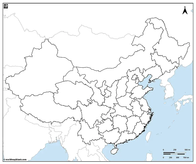
Download as PDF (A4)
Download as PDF (A5)
You can use this map to teach or learn about China’s neighboring countries and the geographical and political context of the countries in Asia. It might also serve for analyzing border disputes, as a visual aid for diplomatic discussions, or tracking your travels through China and other countries. Like all our blank maps of China, it is a great educational tool for geography and history classes.
What Are the Neighboring Countries of China?
The 14 neighboring countries of China are Afghanistan, Bhutan, India, Kazakhstan, Kyrgyzstan, Laos, Mongolia, Myanmar (Burma), Nepal, North Korea, Pakistan, Russia, Tajikistan, and Vietnam.
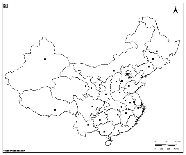
Outline Map of China with Capitals
China’s capital, Beijing, is a focal point of politics, culture, and history. With our outline map of China with capitals, you can locate Beijing and teach or learn about the administrative centers of the country’s provinces and regions.
Here is a list of all Chinese capitals with the relevant province or region name in brackets:
- Beijing (Beijing)
- Changchun (Jilin)
- Changsha (Hunan)
- Chengdu (Sichuan)
- Chongqing (Chongqing)
- Fuzhou (Fujian)
- Guangzhou (Guangdong)
- Guiyang (Guizhou)
- Haikou (Hainan)
- Hangzhou (Zhejiang)
- Harbin (Heilongjiang)
- Hefei (Anhui)
- Hohhot (Inner Mongolia)
- Hong Kong (Hong Kong SAR)
- Jinan (Shandong)
- Kunming (Yunnan)
- Lanzhou (Gansu)
- Lhasa (Tibet – Xizang)
- Macau (Macau SAR)
- Nanchang (Jiangxi)
- Nanjing (Jiangsu)
- Nanning (Guangxi Zhuang)
- Shanghai (Shanghai)
- Shenyang (Liaoning)
- Shijiazhuang (Hebei)
- Taipei (Taiwan)
- Taiyuan (Shanxi)
- Tianjin (Tianjin)
- Urumqi (Xinjiang Uyghur)
- Wuhan (Hubei)
- Xi’an (Shaanxi)
- Xining (Qinghai)
- Yinchuan (Ningxia Hui)
- Zhengzhou (Henan)
Download as PDF (A4)
Download as PDF (A5)
Use this map to identify and learn about China’s major cities, urban landscapes, and the distribution of key population centers. Have students label and color China’s provinces and major cities, or incorporate it in your educational materials for social studies classes. The outline map of China with capitals can also be helpful to plan visits to key urban centers or to enhance your presentations and reports.
For more in-depth demographic and cultural information, you can explore reliable sources such as China’s Demographics and Ethnic Diversity on the CIA World Factbook and China: Culture on Britannica.
Additional Map Resources and Learning Materials
Apart from the China blank maps on this page, we offer a wide range of additional map resources and learning materials. Further below, we provide a collection of direct links to some of our most popular maps. Alternatively, please use the search feature in the header menu.
If you have specific map inquiries or require customized maps for your educational or professional needs, please don’t hesitate to contact us. We’re here to assist you in your journey of exploration and learning. Feel free to explore the following resources to expand your knowledge of global geography and enhance your educational experience:
World Maps
- Blank World Map
- World Map with Oceans and Seas
- Political World Map
- World Map with Latitudes and Longitudes
Continent Maps
- Blank Map of Asia
- Blank Map of North America
- South America Map with Countries
- Blank Map of Europe
- Africa Map with Countries
- Blank Map of Africa
Country Maps
- USA Interstate Highways Maps
- United States Map
- Blank USA Map
- Canada Province Map
- Blank Map of Mexico
- Blank UK Map
- Germany Map with Cities
- Italy Map with Regions and Cities
- France Map with Regions
With maps created by:
Edelweise Shane Angeles is a skilled GIS Analyst and Cartographer from Davao City, Philippines. Holding a Bachelor's in Geology and Earth Science, he specializes in creating practical, clear maps using tools like Global Mapper, ArcGIS, ArcMap, and Google Earth Pro. Edelweise creates both blank and labelled maps for World Map Blank.


