Printable Blank Map of Indonesia- Outline, Transparent, PNG Map
Blank Map of Indonesia is a decent and useful source of learning and drawing the outer boundaries of Indonesia. The map is very useful for beginners to learn drawing the full-fledged map of the country. Indonesia is a Southeast Asian country that is primarily located between the Pacific and Indian oceans and is known as the country of massive islands making it the world’s largest island country.
- Blank Map of Sri Lanka
- Blank Map of Suriname
- Printable Map of France
- Blank Map of Armenia
- World map with longitude
- World map with continents
- Blank map of World
- Labeled map of North America
- Labeled map of Asia
- Physical map of World
- Labeled map of South America
- Labeled map of Africa
- Printable Map of Egypt
- Printable Map of Ethiopia
- Labeled map of Europe
- World map poster
- Labeled map of Antarctica
- World map with oceans
- World time zone map
- Printable Map of Azerbaijan
- Labeled Map of World
- Printable Map of Sudan
- Blank map of Asia
- Political Map of World
- Printable Map of Finland
- Printable Map of Fiji
- Blank Map of Switzerland
- Blank Map of Syria
- Blank Map of Sweden
- Blank Map of Uganda
- Blank Map of Ukraine
- Blank Map of Tajikistan
- Blank Map of Venezuela
- Blank Map of Vanuatu
Further talking about the population of the country which is approximately 267 million people standing it on the 4th position in the context of population. Indonesia is also the world’s largest Muslim majority Nation with a minority of other religions.
Well, here in this article we will provide our guests and users with the various types of blank printable map templates of the country. Using these templates they can learn the geography of the country and also draw the complete map of Indonesia.
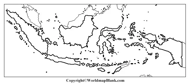
Indonesia Blank Map Outline
The best way to start drawing or learning to draw the map of Indonesia is by referring to the blank outlined map of the country. This blank map of the country is comprised of the outlined structure of the country, by which anyone can easily draw the map of Nation.
The map is extremely user friendly as by the outlines users or scholars can portray any physical structure of the country for their specific use. You can check out the printable template of this blank Indonesian map here.
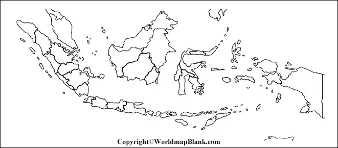
Printable Map of Indonesia
Our aim is to minimize the efforts and save precious time of our scholars who are seeking a decent map of Indonesia but are having the time constraint. We have a printable map for those of our users, which is readily available to serve their purpose on a single click.
Being the printable map uses can easily carry this map in the digital format unlike the physical map from one place to another. It can be easily shared with other people as well to discuss the geography of the country.
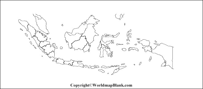
Transparent PNG Indonesia Map
If, you want to have an in-depth and detailed view of the Indonesia map then we urge you to go with the transparent map of the country.
This transparent map would provide you with complete detailed geographical exposure of Indonesia so that you can even witness the smaller geographical objects of the country with an utmost clarity.
For instance, if you want to learn or study the particular island of Indonesia, then you should check it out in the transparent version to read all its underlying physical characteristics.
Map of Indonesia for Practice Worksheet
Well if you want to boost your learned knowledge about the geography of Indonesia then we suggest you to undertake some worksheet to conduct the practice session.

As they say, that practice makes it perfect therefore you should certainly check out your level of understanding for the geography of Indonesia by solving some of the geography-related questions.
Our worksheet has been designed to boost your knowledge about the map of Indonesia by providing you with some decent set of questions in this worksheet.
Related Posts


