Blank Map of Alabama – Outline Map with Counties [PDF]
Do you need a blank map of Alabama or an outline map of Alabama? Then you can find it here! All our black-and-white Alabama maps are great for educational, professional, or private purposes. You can download and print them to teach kids about the state of Alabama, plan a trip, and do other activities.
Choose from our five versions of an Alabama blank map and download them for free! All maps on this page are available in PDF and two different sizes, A4 and A5.
Apart from blank Alabama state maps, we provide many USA maps and other free geography resources about the world, continents, and countries. Finally, we offer a collection of USA map worksheets and other learning resources. Check them out!
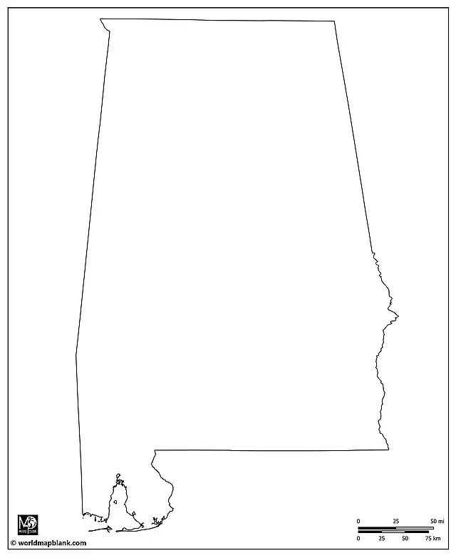
Outline Map of Alabama
Alabama, known as the “Heart of Dixie”, is steeped in rich history and cultural heritage. Located in the southeastern region of the United States, it’s bordered by Tennessee to the north, Georgia to the east, Florida and the Gulf of Mexico to the south, and Mississippi to the west. Covering an area of 52,420 square miles, Alabama is the 30th largest state in the USA.
As of the latest official estimates, Alabama’s population is around 5 million, making it the 24th most populous US state. The state boasts a diverse ethnic makeup, with significant populations of both African American and Caucasian residents, along with growing Hispanic and Asian communities.
Download as PDF (A4)
Download as PDF (A5)
The first map in our collection is an outline Alabama map, only showing the state’s outer borders without internal divisions. This map outline is a great starting point for various educational activities or a base for more detailed geographical exploration. It can be used to draw all kinds of landmarks, shapes, and patterns on the map.
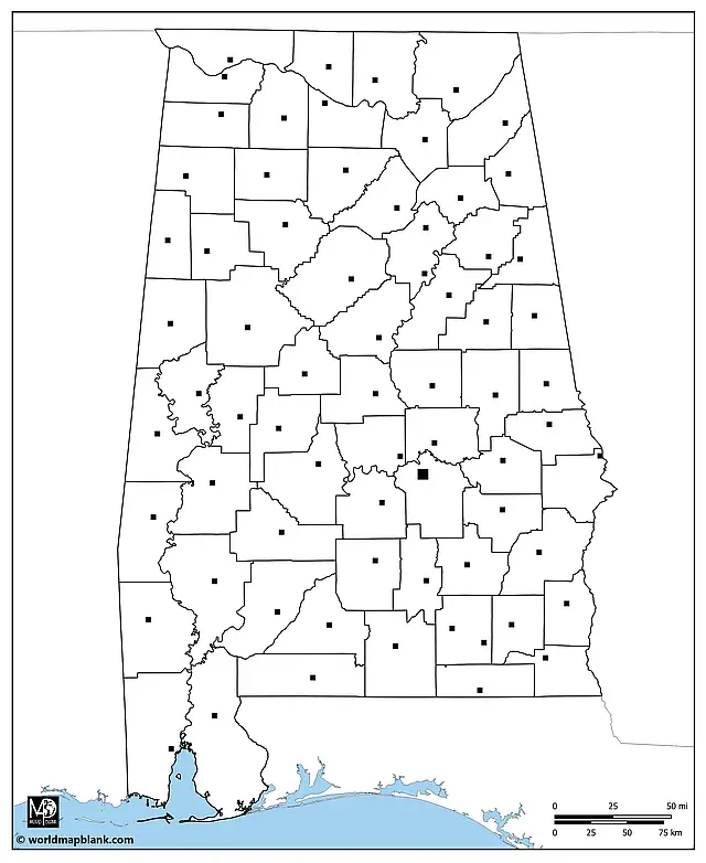
Blank Map of Alabama Counties
Alabama is divided into 67 counties, with significant population variations across them. Jefferson County is the most populous, housing Birmingham, the state’s largest city. On the other end of the spectrum, Greene County is one of the least populated.

Download as PDF (A4)
Download as PDF (A5)
Our above blank printable map of Alabama showcases all county borders, offering an invaluable tool for educational exercises: Can you identify counties or illustrate demographic trends or election results across the state?
If you need more detailed Alabama county maps, please scroll down further. You will find additional maps on this page, including county seats and other cities. These are accompanied by a list of all Alabama counties and county seats.
Alabama Outline Map with Neighboring States
Our following Alabama outline map includes the borders to the neighboring states of Tennessee, Georgia, Florida, and Mississippi. Also, a small part of the Gulf of Mexico is shown. You can use this map to teach about Alabama in the context of its location in the southeast of the United States.
Download as PDF (A4)
Download as PDF (A5)
In addition to this, a blank map of the USA or a political USA map showing all the state names might be helpful. For learning purposes, please take a look at the USA geography worksheets.
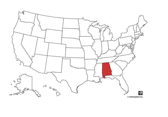
Alabama on a Map
Here is a map showing the location of Alabama in the United States.
Download as PDF (A4)
Download as PDF (A5)
This map was made with a tool named MapChart.
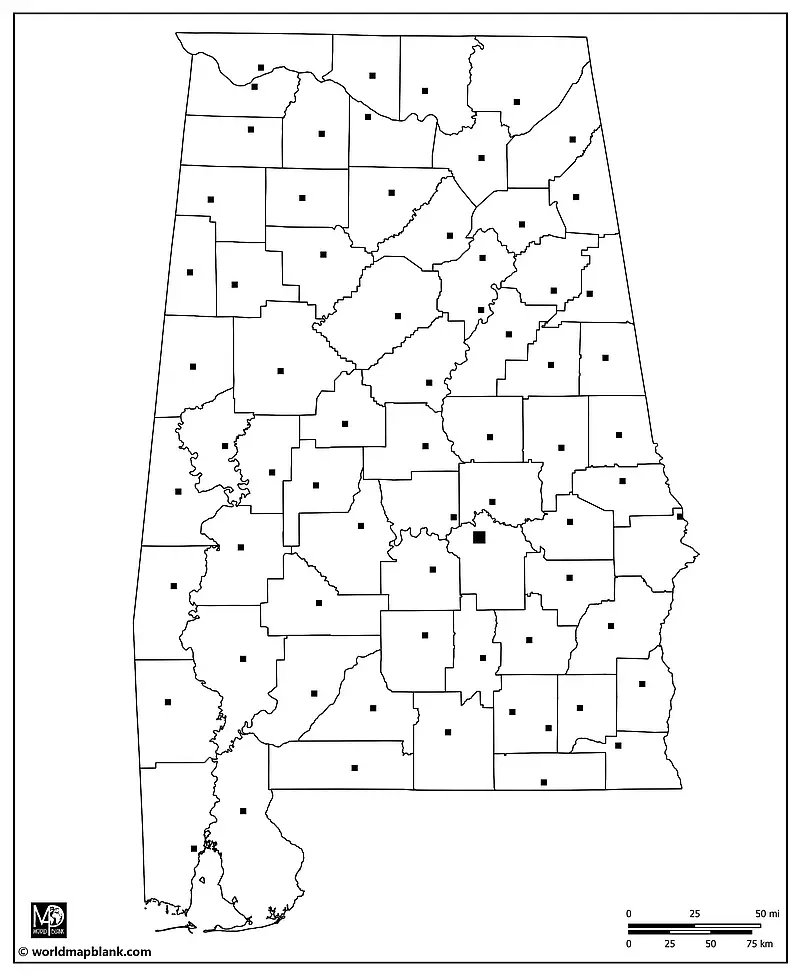
Blank Map of Alabama with County Seats
Each of Alabama’s 67 counties has a designated county seat, which serves as the administrative center. The following detailed map outlines the counties and marks the locations of their respective county seats. Consequently, you can use this map for exercises to learn all the county seat names or for tests and exams.
Download as PDF (A4)
Download as PDF (A5)
Here is an alphabetical list of all the counties in Alabama, along with their respective county seats:
- Autauga County (Prattville)
- Baldwin County (Bay Minette)
- Barbour County (Clayton)
- Bibb County (Centreville)
- Blount County (Oneonta)
- Bullock County (Union Springs)
- Butler County (Greenville)
- Calhoun County (Anniston)
- Chambers County (Lafayette)
- Cherokee County (Centre)
- Chilton County (Clanton)
- Choctaw County (Butler)
- Clarke County (Grove Hill)
- Clay County (Ashland)
- Cleburne County (Heflin)
- Coffee County (Elba)
- Colbert County (Tuscumbia)
- Conecuh County (Evergreen)
- Coosa County (Rockford)
- Covington County (Andalusia)
- Crenshaw County (Luverne)
- Cullman County (Cullman)
- Dale County (Ozark)
- Dallas County (Selma)
- DeKalb County (Fort Payne)
- Elmore County (Wetumpka)
- Escambia County (Brewton)
- Etowah County (Gadsden)
- Fayette County (Fayette)
- Franklin County (Russellville)
- Geneva County (Geneva)
- Greene County (Eutaw)
- Hale County (Greensboro)
- Henry County (Abbeville)
- Houston County (Dothan)
- Jackson County (Scottsboro)
- Jefferson County (Birmingham)
- Lamar County (Vernon)
- Lauderdale County (Florence)
- Lawrence County (Moulton)
- Lee County (Opelika)
- Limestone County (Athens)
- Lowndes County (Hayneville)
- Macon County (Tuskegee)
- Madison County (Huntsville)
- Marengo County (Linden)
- Marion County (Hamilton)
- Marshall County (Guntersville)
- Mobile County (Mobile)
- Monroe County (Monroeville)
- Montgomery County (Montgomery)
- Morgan County (Decatur)
- Perry County (Marion)
- Pickens County (Carrollton)
- Pike County (Troy)
- Randolph County (Wedowee)
- Russell County (Phenix City)
- St. Clair County (Pell City, Ashville)
- Shelby County (Columbiana)
- Sumter County (Livingston)
- Talladega County (Talladega)
- Tallapoosa County (Dadeville)
- Tuscaloosa County (Tuscaloosa)
- Walker County (Jasper)
- Washington County (Chatom)
- Wilcox County (Camden)
- Winston County (Double Springs)
Blank Alabama Map with Cities and Towns
Alabama is home to several major cities, each with its unique character and history. Birmingham, Montgomery (the state capital), Mobile, Huntsville, and Tuscaloosa are among the state’s largest and most significant urban centers. Our last map includes markers for these cities and many others, providing an excellent resource for studying urban distribution and planning travels within Alabama.

Download as PDF (A4)
Download as PDF (A5)
But, of course, you or your students will have to label them first!
Apart from the county seats listed earlier, the following cities and towns are marked on the map above (in alphabetical order):
Addison, Albertville, Alabaster, Alexander City, Aliceville, Arab, Ashford, Attalla, Auburn, Autaugaville, Beatrice, Berry, Branchville, Brantley, Bridgeport, Brundidge, Camp Hill, Carbon Hill, Castleberry, Cedar Bluff, Cherokee, Chickasaw, Childersburg, Collinsville, Cordova, Cottonwood, Courtland, Daleville, Edwardsville, Elkmont, Foley, Frisco City, Gardendale, Georgiana, Gilbertown, Goodwater, Graysville, Greensboro, Guin, Hackleburg, Hanceville, Hartselle, Hartford, Headland, Hokes Bluff, Holt, Hoover, Hurtsboro, Jackson, Jacksonville, Kennedy, Lake Purdy, Lanett, Lexington, Lineville, Lisman, Littleville, Lockhart, Locust Fork, Loxley, Louisville, Lowndesboro, Maplesville, McIntosh, Meridianville, Midway, Millry, Napier Field, Northport, Oakman, Opp, Orrville, Oxford, Phil Campbell, Pickensville, Pine Hill, Pleasant Grove, Ragland, Rainsville, Red Bay, River Falls, River View, Roanoke, Rogersville, Samson, Sulligent, Sylacauga, Stevenson, Thorsby, Thomaston, Thomasville, Tillmans Corner, Uniontown, West Blocton, York.
More Free Blank Maps of US States
We offer more free blank maps of US states for you to download from our site. Here are a few examples of other printable state maps in black-and-white you might be interested in:
- Blank Map of California
- Arizona Outline Map
- Blank Map of Texas
- Oklahoma Outline Map
- Blank Map of Florida
- Colorado Outline Map
- Blank Map of Tennessee
If your desired outline US state map is not listed here, you can check out our overview page of USA maps. We regularly add more free PDF maps with state outlines to our collection.
Additional Free PDF Maps
Finally, you can download many other free maps from our site. Below are a few examples, but there are many more than listed here! You can just take a look at our various categories or use the search feature in the top menu of this page.
World Maps
- Printable Blank World Map
- Political World Map
- World Map for Kids
- World Map with Oceans and Seas
- Latitude and Longitude World Map
Country Maps
- Canada Map with Provinces
- Blank Canada Map
- Outline Map of Mexico
- Blank Map of Argentina
- Political Germany Map with States
Continent Maps
Related Posts


