Blank Map of Pakistan – Outline Map of Pakistan [PDF]
A blank map of Pakistan is a great tool to get familiar with the administrative units of Pakistan. With an outline map of Pakistan, you can learn and practice or teach about the provinces, territories, cities, and other geographical features of this Asian country.
All outline maps of Pakistan on this page are free to download and print. You can save them on your device as PDF files or print them directly from your browser. We offer several versions with more or less details, such as country borders, provincial boundaries, or markers for the largest cities.
Please note that some of our maps include territories that have been disputed between Pakistan and India since the First Kashmir War of 1947–1948. We do not intend to take any position in the Kashmir conflict but provide various maps with different interpretations. The same is true for our blank map of India page and our blank map of Asia article.
Now browse our blank Pakistan map collection and download or print any map that is helpful for your educational, professional, or personal purposes!
Outline Map of Pakistan
Our first map is a Pakistan outline map showing only the outer boundary of the country. It is our least detailed black-and-white map of Pakistan and is useful for drawing in mountain ranges, rivers, etc. Since it does not include any markers or provincial borders, it is simultaneously the most versatile map outline of Pakistan we offer.
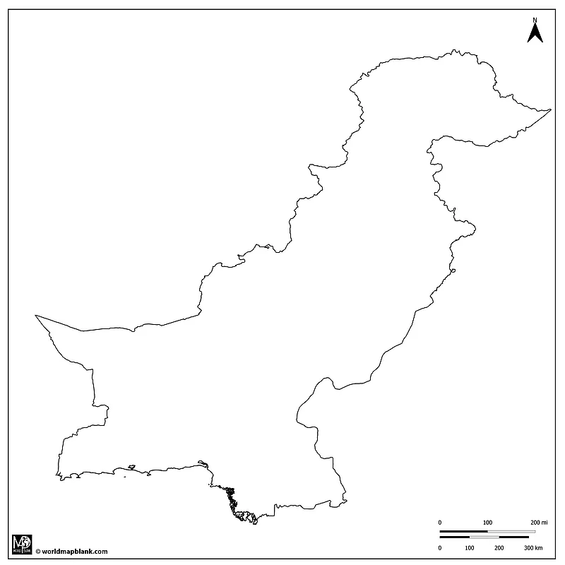
Download as PDF (A4)
Download as PDF (A5)
Pakistan, officially known as the Islamic Republic of Pakistan, is a country in South Asia. Covering an area of approximately 340,509 square miles (881,913 square kilometers), Pakistan is the world’s 34th-largest country by area (source). According to the census conducted from March to May 2023, Pakistan has a population of 241.5 million people (source), making it the world’s fifth-most populous country in the world.
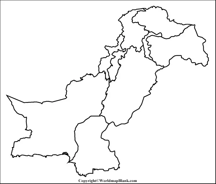
Blank Map of Pakistan with Provinces
Our following map is a blank map of Pakistan with provinces, including not only the outer country boundary but also the provincial borders. It can be used for coloring the Pakistani provinces and adding their names to the map.
Do you know the location of the provincial capital cities? Then try to draw them into the map! The same could be done with Asian mountain ranges, high peaks, rivers, roads, or the locations of the 10 national monuments of Pakistan.
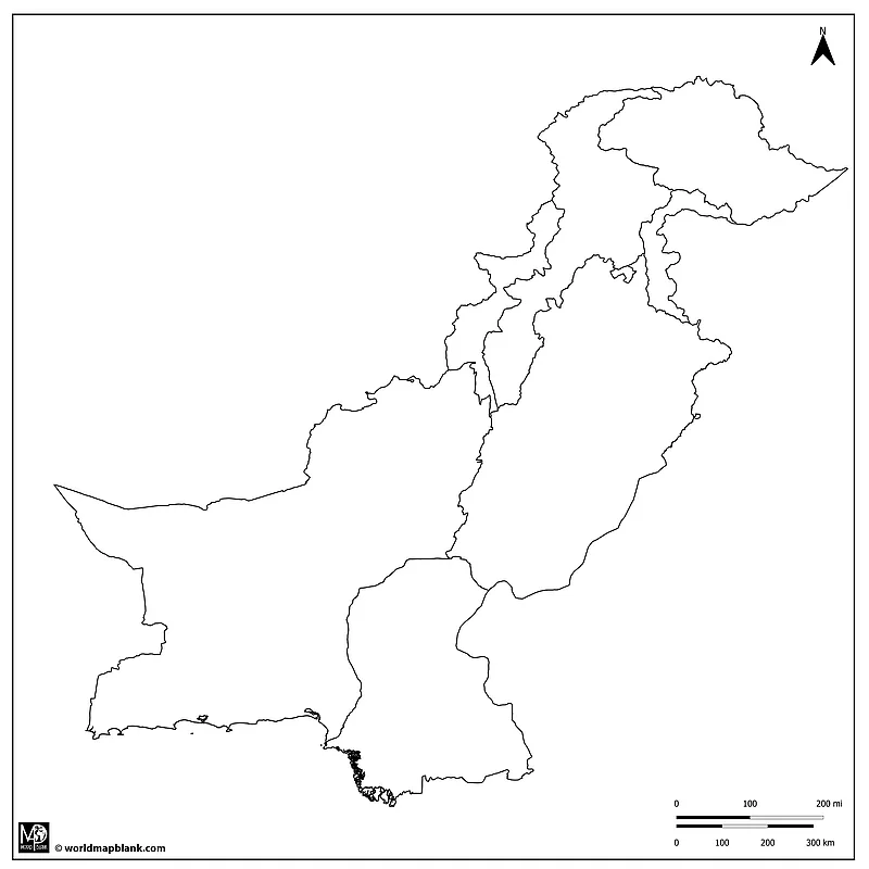
Download as PDF (A4)
Download as PDF (A5)
Religion plays a central and defining role in the cultural and social life of Pakistan. The country was established in 1947 as a nation for Muslims of the Indian subcontinent, and Islam is its state religion.
Not surprisingly, the vast majority of Pakistanis are Muslims, with Sunni Islam being the predominant sect, followed by a significant minority of Shi’a Muslims. The influence of Islam is evident in every aspect of Pakistani society, from its legal system and educational institutions to social norms and daily practices.
In addition to the Muslim majority, there are various religious minorities in Pakistan, including Hindus, Christians, Sikhs, and others.
Blank Outline Map of Pakistan with Capitals
Here is another Pakistan map outline with provinces, additionally including markers for the provincial capitals. This makes it easier to practice the names of these capitals and their relevant provinces. This makes the map an ideal tool for learning activities in school or even tests and exams.
Here is a list of all the provinces and territories of Pakistan with their capital cities:
- Balochistan (province) – Quetta
- Islamabad Capital Territory (federal territory) – Islamabad
- Khyber Pakhtunkhwa (province) – Peshawar
- Punjab (province) – Lahore
- Sindh (province) – Karachi
- Azad Jammu and Kashmir (administrative territory) – Muzaffarabad
- Gilgit-Baltistan (administrative territory) – Gilgit
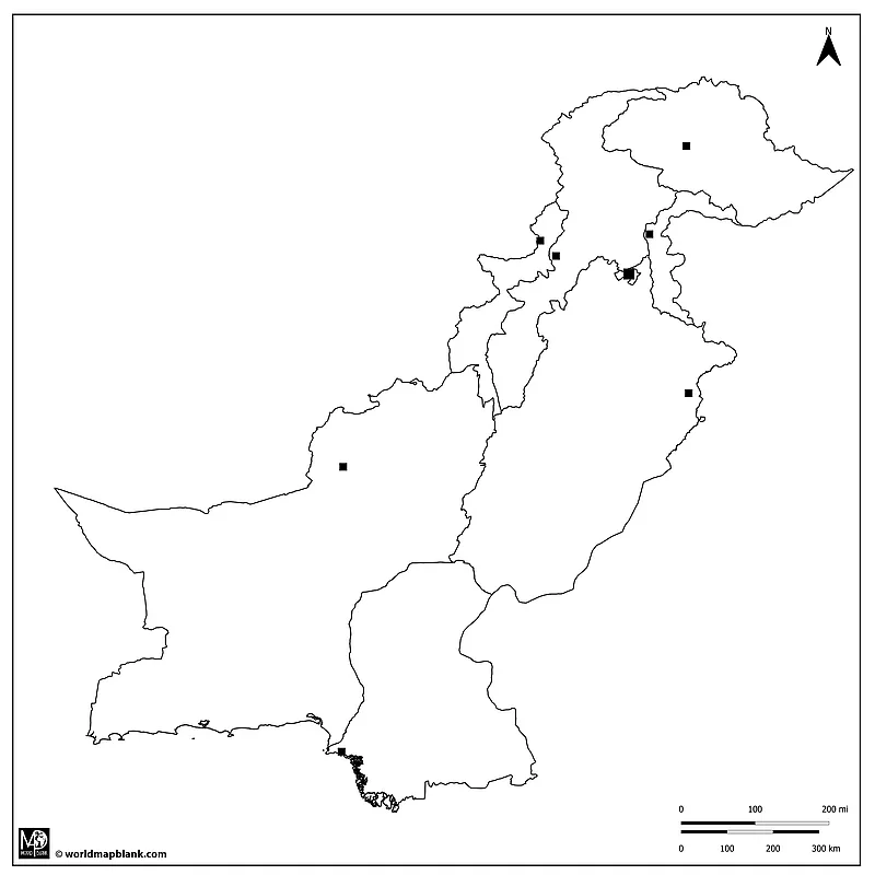 Download as PDF (A4)
Download as PDF (A5)
According to its constitution, Pakistan recognizes two official languages: Urdu and English. Urdu is the national language and lingua franca of Pakistan, even though it is the mother tongue of only a minority of Pakistanis. Urdu has a long poetic and literary tradition and plays a crucial role in national identity and cohesion. English is used extensively in government, the legal system, business, and higher education. It is also a symbol of the country’s colonial past and remains a language of prestige and upward mobility.
Apart from these official ones, many other regional languages reflect Pakistan’s ethnic diversity. Among these are Punjabi (the most widely spoken language in Pakistan), Pashto (spoken by the Pashtun people), Sindhi, Balochi, Saraikin, and numerous other regional languages and dialects.
Activity idea: Can you shade the areas where the main Pakistani languages are spoken on the map?
Outline Map of Pakistan with Neighboring Countries
Pakistan has international land borders with Afghanistan, China, Iran, and India. Additionally, only the Wakhan Corridor, which belongs to the Badakhshan province of Afghanistan, separates the country from Tajikistan. Finally, Pakistan shares a direct maritime border with Oman through the Arabian Sea.
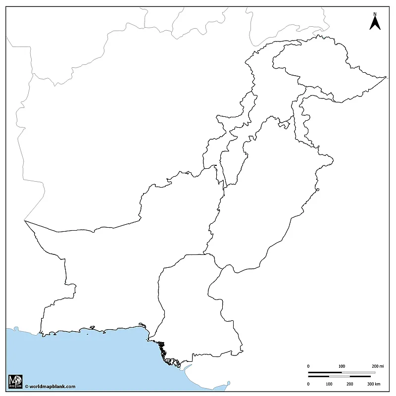
Download as PDF (A4)
Download as PDF (A5)
The above map is a Pakistan map outline with neighboring countries. Can you add all their names to the map? Also, add the name of the water body south of Pakistan. Our world map with seas can help you in this task.
Pakistan Map Outline with Cities
Apart from the provincial capitals, our following Pakistan outline map includes the locations of many large cities. Can you add their names next to the relevant dot? The list below will help you:
- Bahawalpur
- Bannu
- Dera Ismail Khan
- Gilgit
- Islamabad
- Jhang
- Karachi
- Kundian
- Lahore
- Larkana
- Mirpur Khas
- Multan
- Muzaffarrabad
- Nawabshah
- Okara
- Peshawar
- Quetta
- Sadiqabad
- Saidu
- Sargodha
- Torkham
- Turbat
- Zhob
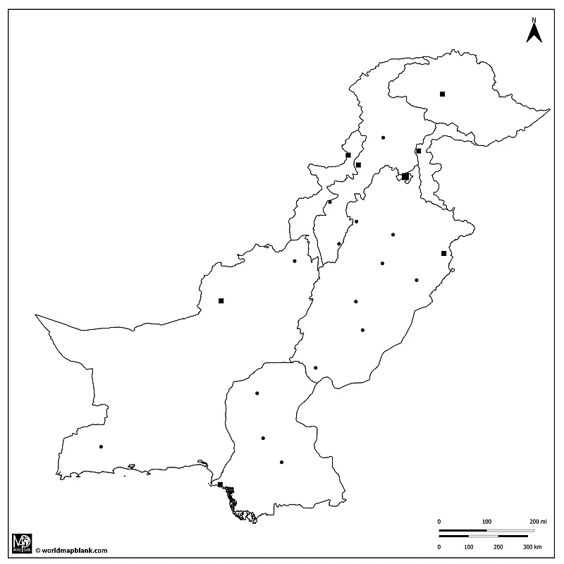
Download as PDF (A4)
Download as PDF (A5)
Some of the larger cities in Pakistan are missing from the above map. Can you add their locations and names? The below list of the 10 major cities in Pakistan (source) will help you:
- Karachi
- Lahore
- Faisalabad
- Rawalpindi
- Gujranwala
- Peshawar
- Multan
- Hyderabad
- Islamabad
- Quetta
Printable Blank Map of Pakistan PDF
Here is another simple Pakistan map outline PDF for you to download, which is also available in two different sizes.
Download as PDF (large)
Download as PDF (small)
This is one of our older versions of a blank map of Pakistan. All other maps above have been created later and with more details, such as a scale indicating distances in miles and kilometers.
Pakistan on a Map
Finally, you might wonder where Pakistan is located. Our last two maps answer this question visually. They were created with a tool called MapChart.
Pakistan on the World Map
On a world map, Pakistan is situated on the Asian continent and lies approximately between latitudes 24° and 37° North and longitudes 61° and 77° East. It is located in the Eastern Hemisphere and the Northern Hemisphere. Pakistan’s neighboring countries are India to the east, Iran to the west, Afghanistan to the northwest, and China to the northeast. Pakistan also has a southern coastline along the Arabian Sea, which is part of the northern Indian Ocean.
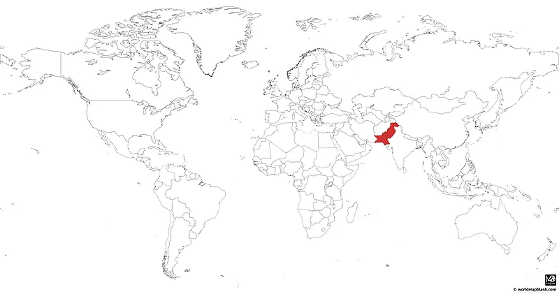
Download as PDF (A4)
Download as PDF (A5)
To the north, Pakistan is relatively close to Central Asian countries, such as Kyrgyzstan, Uzbekistan, and Turkmenistan. It is also near the Middle East, with the Arabian Peninsula situated southwest across the Arabian Sea.
Pakistan on a Map of Asia
Our last map shows Pakistan’s location on a blank map of Asia. The country can be found in the western part of the South Asian subcontinent. The Himalayas, a major mountain range in Asia, extend into the northern part of Pakistan.
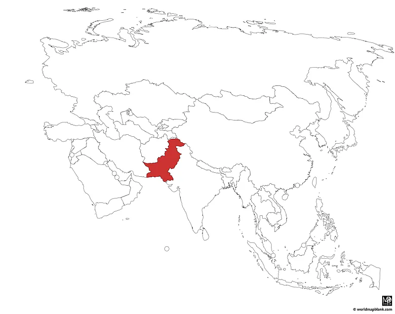
Download as PDF (A4)
Download as PDF (A5)
This concludes our map collection of Pakistan outline maps. If you are looking for related maps, try out our blank map of India and our printable blank map of Asia. Also, we are constantly updating our maps, so please check in again later to find more exciting free maps of Asian countries and other parts of the world.
Popular Maps
Below, we have included a link list to some of our most popular maps. If your desired map is not listed, please use the search feature in the top menu. You can also contact us to order a customized map tailored to your specific needs. And finally, check out our geography worksheets with fun and interactive learning activities!
World Maps
- Blank World Map
- Oceans Map of the World
- Latitude and Longitude World Map
- Political World Map
- World Map for Kids
Continent Maps
- Blank North America Map
- Europe Outline Map
- Africa Map with Countries
- Blank Map of Africa
- South America Outline Map
Country Maps
Special Maps
Related Posts


