
🇮🇪 Printable Map of Ireland with Counties
🇮🇪 Printable Map of Ireland with Counties
✅ Free download – PDF and JPEG, ready to print.
Download a printable map of Ireland with counties for geography teaching, practice worksheets, classroom exercises, homeschooling, presentations, travel planning, and more.
Couldn't load pickup availability
Add multiple maps to the cart to download them all at once.
Download your free printable map of Ireland with counties as a JPEG image and a PDF file!
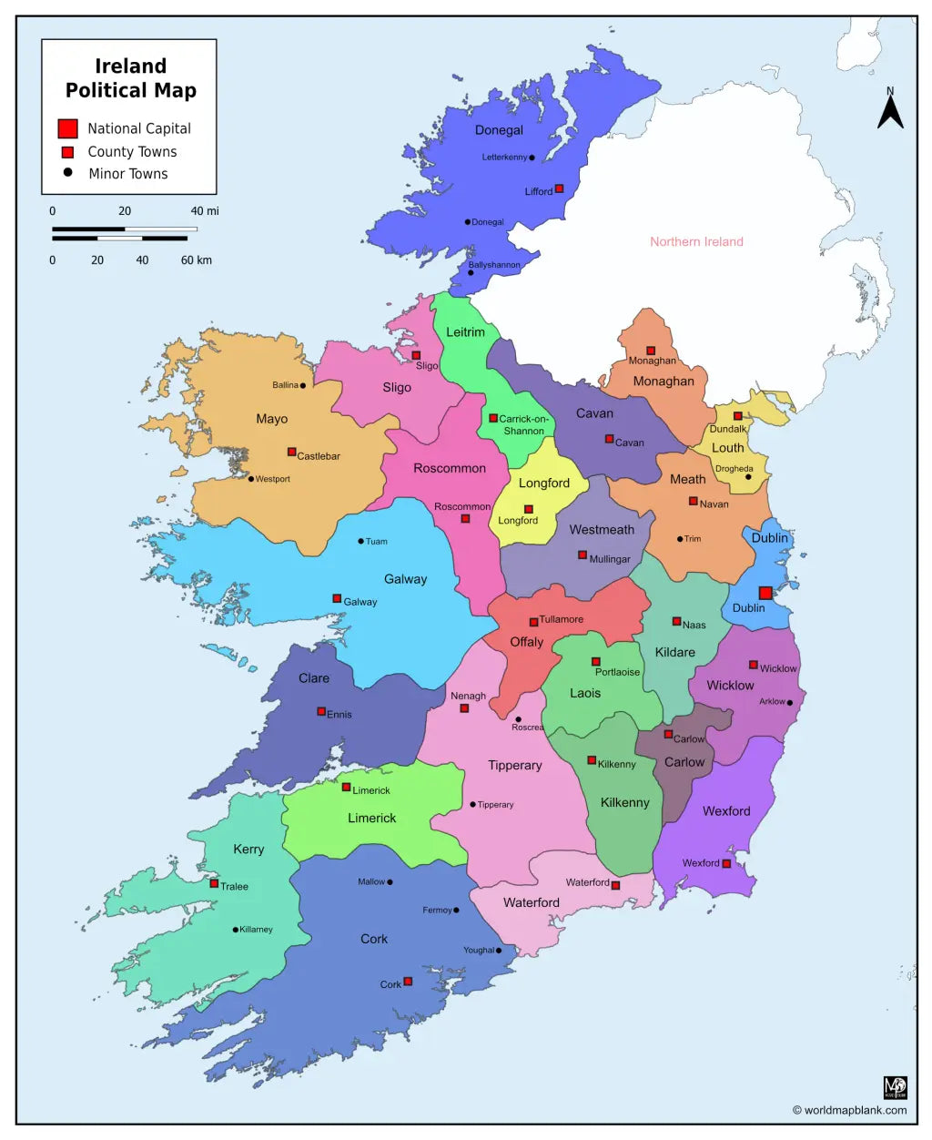
We also offer a printable, high-resolution political map of Ireland with counties, county seats, and towns (7860 x 9607 px).
Or get your Ireland labeled maps bundle, including:
🗺 Printable map of Ireland with counties
🗺 Ireland county map with county seats
🗺 Political Ireland map with counties, county seats, and towns
All versions include PDF and JPEG versions of the maps.
The maps with counties and/or county seats include markers for:
Carlow (Carlow), Cavan (Cavan), Clare (Ennis), Cork (Cork), Donegal (Lifford), Dublin (Dublin), Galway (Galway), Kerry (Tralee), Kildare (Naas), Kilkenny (Kilkenny), Laois (Portlaoise), Leitrim (Carrick-on-Shannon), Limerick (Limerick), Longford (Longford), Louth (Dundalk), Mayo (Castlebar), Meath (Navan), Monaghan (Monaghan), Offaly (Tullamore), Roscommon (Roscommon), Sligo (Sligo), Tipperary (Nenagh), Waterford (Waterford), Westmeath (Mullingar), Wexford (Wexford), and Wicklow (Wicklow)
The map with towns includes additional markers for:
Arklow, Ballina, Ballyshannon, Donegal, Drogheda, Fermoy, Killarney, Letterkenny, Mallow, Roscrea, Tipperary, Trim, Tuam, Westport, Youghal


Download your free map
Enter your email and tell us how you'll use the map. Your download starts immediately.