Labeled Map of South America with Countries in PDF
Use a labeled map of South America to learn the geography of the continent. Get familiar with the names and locations of the South American countries, capital cities, physical features, and more.
This map is a great resource for students, teachers, and anyone else who wants to learn about this important part of Latin America. Simply download the PDF file and print it out on your home printer. Any labeled map of South America from this page is yours to use for free.
Also, enhance your map collection with our printable blank map of South America!
Labeled Map of South America
The South American continent is located in the western hemisphere with most of its land mass situated in the southern hemisphere. Consequently, only a relatively small portion of South America is situated in the northern hemisphere. The continent is flanked by the Pacific Ocean in the west and the Atlantic Ocean in the north and east. The Caribbean Sea and North America are in the north and northwest.
Labeled South America Map with Countries
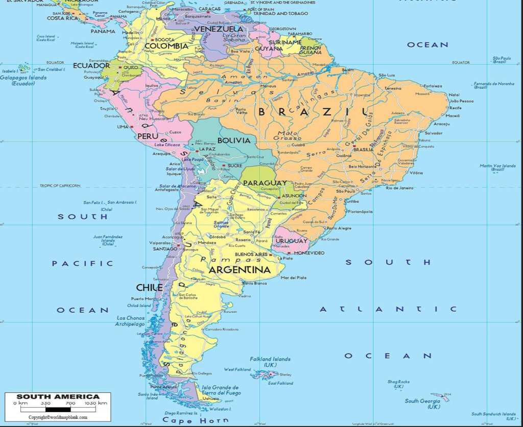
As you can see from the labeled map of South America, the continent is divided into twelve sovereign countries. These include Venezuela, Uruguay, Suriname, Peru, Paraguay, Guyana, Ecuador, Colombia, Chile, Brazil, Bolivia, and Argentina. The thirteenth territory, known as French Guiana, is an overseas department of France. Furthermore, there are the British overseas territories of the Falkland Islands as well as South Georgia and the South Sandwich Islands.
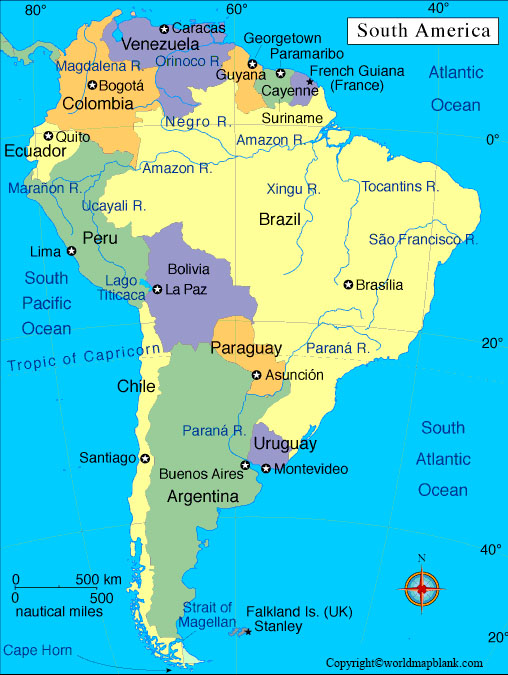
Together, these countries cover an area of 6.895 million square miles. With a population of over 434 million people, South America is home to some of the largest countries in the world. Brazil is the largest country on the continent, with a population of over 214 million people. It is followed by Colombia, with a population of over 50 million people. Argentina rounds out the top three countries, with an estimated population of over 47 million people.
Labeled South America Map with Capitals
The labeled South America map with capitals shows all the capitals and the national borders of the twelve independent countries as well as the overseas territories. You will find the locations of Brasilia, Buenos Aires, Bogotá, Caracas, La Paz, Santiago, Asunción, Lima, Montevideo, Quito, Paramaribo, Cayenne, Georgetown, and Stanley.
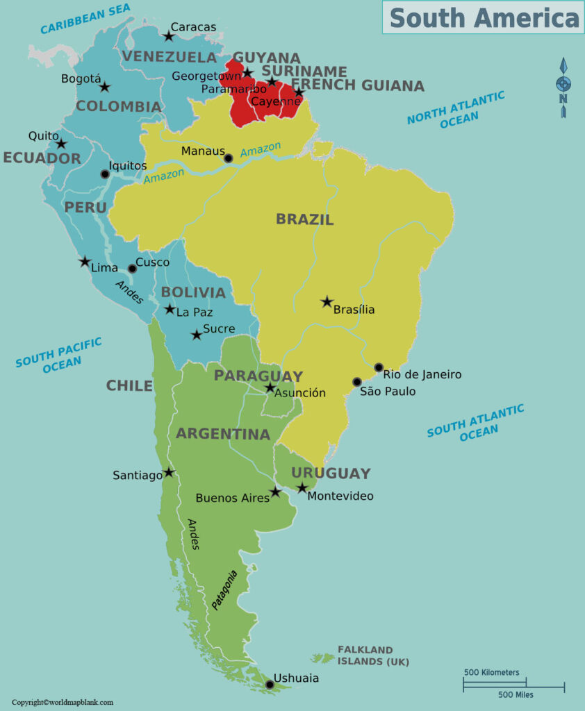
Additionally, the labeled map of South America illustrates the largest rivers of the continent. The Amazon River is the largest river in South America, and it is also one of the most impressive rivers in the world. It runs through the rainforest and empties into the Atlantic Ocean.
The Paraná River is another major river in South America. It flows through Argentina, Brazil, Paraguay, and Uruguay before entering the Atlantic Ocean. The Rio de la Plata is a large estuary formed by the confluence of the Paraná and Uruguay rivers. It is located in Argentina and Uruguay. Finally, the Orinoco River is the third-longest river in South America. It runs through Venezuela and Colombia and empties into the Atlantic Ocean.
South America Map with Cities Labeled
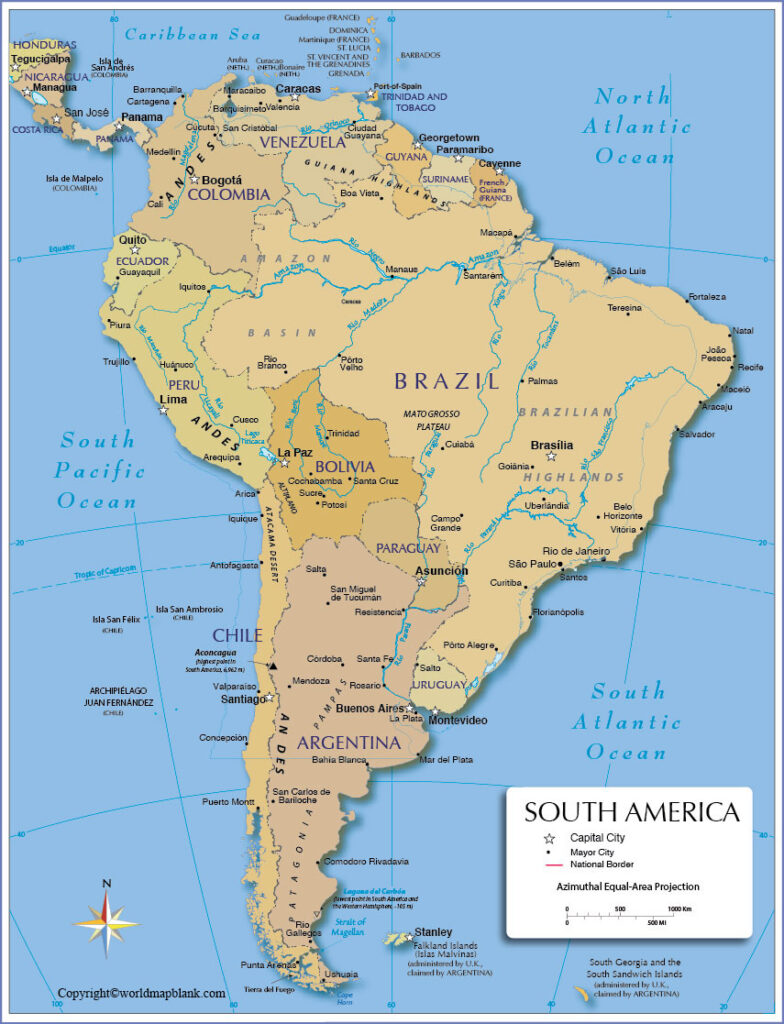
Our South America map with cities labeled shows both the capitals of each country and other important metropolises. São Paulo is the most populous city in Brazil, the Americas, and the Western Hemisphere. It is also the 4th largest city by population in the world. São Paulo is located on the coast of southeastern Brazil and is home to a diverse population of over 12 million people. The metropolitan area of Greater São Paulo even has a population of 22 million.
Other major cities in South America include Buenos Aires (Argentina), Lima (Peru), Bogota (Colombia), and Caracas (Venezuela). The second largest city in Brazil is Rio de Janeiro.
South America Map PDF
A free South America map with all the cities labeled is a great tool for teachers, researchers, or students. You can download any map from this page free of charge as a PDF file and print as many copies as you need. You might also want to use these maps as a poster for a classroom wall, for homework assignments or in exams.
Get your South America labeled map and combine it with a blank map of South America or a labeled physical map of South America. Together, these will help you to teach your class about the geography of South America including the Andes mountains, the Amazon basin and other important features.
Other Free Printable Maps to Download
Below you’ll find some links to other maps that might be useful or interesting. You can also explore more maps via our search feature. If none of our maps suits your needs, please get in touch via our contact form. Our team will do their best to find or create any missing map and make it available.
Finally, we also offer ready-made but editable geography worksheets as well as wall maps and other geography resources.
World Maps
- World Map With Continents
- Blank Map of the World
- Political World Map
- World Map with Longitudes and Latitudes
- Physical World Map
- World Map with Oceans
- World Map Poster
Continent Maps
- Labeled Map of Europe
- Map of North America with Labels
- Labeled Map of Asia
- Map of South America with Labels
- Labeled Map of Africa
- Map of Antarctica with Labels
- Labeled Map of Australia
Blank Maps of Countries
- Blank Map of the UK and Ireland
- Canada Blank Map
- USA map without names
- Printable map of USA
- Blank Map of South Africa
- Ukraine Blank Map
- Blank Map of Germany
- New Zealand Blank Map
- Blank Map of France
- China Blank Map
- Blank Map of Brazil
- Italy Blank Map
- Blank Map of Switzerland

