Blank Map of Arkansas – Outline Map of Arkansas [PDF]
Are you looking for a blank map of Arkansas or an outline map of Arkansas? Then you can get it here! All our blank Arkansas maps are great for educational, professional, or private purposes. Download and print any of them for teaching about the state of Arkansas, travel planning, and other activities.
Please choose from our various versions of an Arkansas outline map and download them for free! All maps on this page are available in PDF and two sizes, A4 and A5.
Apart from blank Arkansas state maps, we provide many USA maps and other free geography resources about the world, continents, and countries. Finally, we also offer USA map worksheets with fun learning activities about the states of the USA.
Outline Map of Arkansas
Arkansas, nestled in the southern region of the United States, is known for its diverse landscapes that range from the mountainous areas of the Ozarks and the Ouachita Mountains to the densely forested land in the south known as the Arkansas Timberlands. Bordered by Missouri to the north, Tennessee and Mississippi to the east, Louisiana to the south, Texas to the southwest, and Oklahoma to the west, Arkansas spans approximately 53,180 square miles, making it the 29th largest state in the USA.
With an estimated population of about 3 million, Arkansas is recognized for its rich cultural heritage and significant contributions to American history and music, particularly the Delta blues. The state’s demographic landscape is a tapestry of various ethnicities, with a significant presence of African-American, Caucasian, and growing Hispanic communities.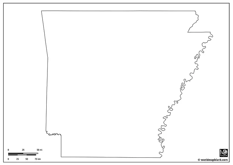
Download as PDF (A4)
Download as PDF (A5)
Our first map provides a clear outline of Arkansas’s state borders. This simple yet effective map outline is an excellent resource for various educational activities, such as understanding the state’s geographical location within the United States or creating a detailed study of its bordering states.
Blank Map of Arkansas with Counties
Arkansas is divided into 75 counties, each with a unique history and cultural identity. Pulaski County is the most populous, home to Little Rock, the state capital and largest city. Conversely, Calhoun County is among the least populated.
This map, showing all the county borders, is perfect for educational projects where students can research and present information on a specific county, exploring its history, demographics, and notable landmarks.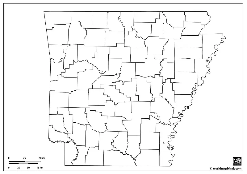
Download as PDF (A4)
Download as PDF (A5)
Our blank map of Arkansas with counties can also be used to track election results or to illustrate the ethnic distribution of the population.
Arkansas Outline Map with Neighboring States
This map presents a blank representation of Arkansas, ideal for various uses. Teachers can use it as a base for geographical quizzes, where students are tasked with identifying the neighboring states of Arkansas or the names of the county seats. Another task could be to draw in major rivers, such as the Mississippi and Arkansas Rivers, or significant geographical landmarks like the Hot Springs National Park.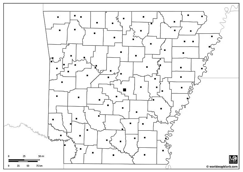
Download as PDF (A4)
Download as PDF (A5)
You can find more Arkansas county maps further down on this page. Just scroll on and click the download links below each image to get your desired map. All of our maps can be used to create geography worksheets.
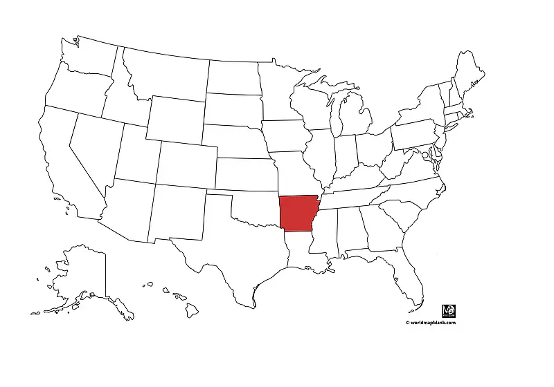
Arkansas on a Map
Our following map indicates the location of Arkansas on a map of the USA. As you can see, Arkansas is a landlocked state surrounded by Texas, Oklahoma, Missouri, Tennessee, Mississippi, and Louisiana.
Download as PDF (A4)
Download as PDF (A5)
The above map was created with a tool called MapChart.
Blank Map of Arkansas with County Seats
Each county in Arkansas has a central administrative location known as a county seat. For example, Bentonville is the county seat of Benton County, and Pine Bluff is the county seat of Jefferson County. However, 10 of Arkansas’ 75 counties have two country seats.
The blank Arkansas map below outlines the counties and marks their county seats, providing a comprehensive perspective on the state’s administrative geography.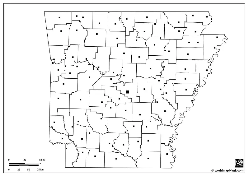
Download as PDF (A4)
Download as PDF (A5)
Students can use this map to name and mark county names and seats. Subsequently, they could create a detailed report on a county seat, exploring its historical importance, demographic changes, or current role in the state’s governance.
Here is an alphabetical overview of all the counties and county seats in Arkansas:
- Arkansas County (De Witt, Stuttgart)
- Ashley County (Hamburg)
- Baxter County (Mountain Home)
- Benton County (Bentonville)
- Boone County (Harrison)
- Bradley County (Warren)
- Calhoun County (Hampton)
- Carroll County (Berryville, Eureka Springs)
- Chicot County (Lake Village)
- Clark County (Arkadelphia)
- Clay County (Corning, Piggott)
- Cleburne County (Heber Springs)
- Cleveland County (Rison)
- Columbia County (Magnolia)
- Conway County (Morrilton)
- Craighead County (Jonesboro, Lake City)
- Crawford County (Van Buren)
- Crittenden County (Marion)
- Cross County (Wynne)
- Dallas County (Fordyce)
- Desha County (Arkansas City)
- Drew County (Monticello)
- Faulkner County (Conway)
- Franklin County (Charleston, Ozark)
- Fulton County (Salem)
- Garland County (Hot Springs)
- Grant County (Sheridan)
- Greene County (Paragould)
- Hempstead County (Hope)
- Hot Spring County (Malvern)
- Howard County (Nashville)
- Independence County (Batesville)
- Izard County (Melbourne)
- Jackson County (Newport)
- Jefferson County (Pine Bluff)
- Johnson County (Clarksville)
- Lafayette County (Lewisville)
- Lawrence County (Walnut Ridge, Powhatan)
- Lee County (Marianna)
- Lincoln County (Star City)
- Little River County (Ashdown)
- Logan County (Booneville, Paris)
- Lonoke County (Lonoke)
- Madison County (Huntsville)
- Marion County (Yellville)
- Miller County (Texarkana)
- Mississippi County (Blytheville, Osceola)
- Monroe County (Clarendon)
- Montgomery County (Mount Ida)
- Nevada County (Prescott)
- Newton County (Jasper)
- Ouachita County (Camden)
- Perry County (Perryville)
- Phillips County (Helena-West Helena)
- Pike County (Murfreesboro)
- Poinsett County (Harrisburg)
- Polk County (Mena)
- Pope County (Russellville)
- Prairie County (Des Arc, DeValls Bluff)
- Pulaski County (Little Rock)
- Randolph County (Pocahontas)
- St. Francis County (Forrest City)
- Saline County (Benton)
- Scott County (Waldron)
- Searcy County (Marshall)
- Sebastian County (Fort Smith, Greenwood)
- Sevier County (De Queen)
- Sharp County (Ash Flat)
- Stone County (Mountain View)
- Union County (El Dorado)
- Van Buren County (Clinton)
- Washington County (Fayetteville)
- White County (Searcy)
- Woodruff County (Augusta)
- Yell County (Dardanelle, Danville)
Copy this list as an answer key for a naming and marking task with the corresponding map.
Arkansas Outline Map with Cities and Towns
Our last Arkansas state outline map is our most detailed one. Additionally to the country borders and county seats, it also includes markers for many other cities and towns.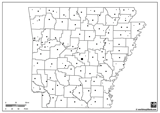
Download as PDF (A4)
Download as PDF (A5)
Apart from the country seats, the following towns and cities are shown in the map above:
Alma, Altus, Atkins, Bald Knob, Bearden, Beebe, Bellefonte, Bluff City, Cabot, Caddo Valley, College City, Concord, Crossett, Delaplaine, Dumas, East Camden, Eudora, Farmington, Flippin, Foreman, Fountain Hill, Gassville, Gravette, Green Forest, Hatfield, Huttig, Imboden, Lake Hamilton, Lead Hill, Lepanto, Lincoln, Manila, Marked Tree, Marmaduke, Marvell, Maynard, McCrory, McDougal, McGehee, Minturn, Newark, Norman, Oak Grove Heights, Pea Ridge, Rector, Sherwood, Siloam Springs, Smackover, Springdale, Strawberry, Strong, Trumann, Tuckerman, Viola, Wilton.
More Free Blank Maps of US States
Apart from the Arkansas blank maps on this page, we offer you many more free US state outlines to download. Here are a few examples of other black-and-white United States state maps you might be interested in:
- Blank Map of California
- Arizona Outline Map
- Blank Map of Texas
- Oklahoma Outline Map
- Blank Map of Florida
- Colorado Outline Map
- Blank Map of Tennessee
- Outline Map of Alabama
If your desired blank printable state map is not listed, check out our overview page of USA maps. We are constantly adding more printable PDF maps to our collection.
Other Free Maps
Finally, we provide world, continent, and many country maps. Here are a few examples of our most popular ones:
World Maps
Continent Maps
- Blank North America Map
- South America Outline Map
- Blank Map of Europe
- Asia Outline Map
- Africa Map with Countries
Country Maps
Related Posts


