Switzerland Outline Map – Blank Map of Switzerland [PDF]
Check out our different versions of a Switzerland outline map or a blank map of Switzerland on this page! You can download any map for free in PDF and print it as often as you need. A blank Switzerland map can be handy for teaching and learning about the country as well as for professional or personal purposes.
Our newer and more detailed outline maps of Switzerland are available in two sizes, A4 and A5. The older ones are only available in A4 printing size.
We also offer a labeled map of Switzerland to make your resources complete.
Switzerland Outline Map
Switzerland is a landlocked European country sharing borders with Austria, Germany, Liechtenstein, Italy, and France. However, Switzerland is not a member of the European Union and thus not included in our labeled EU map.
The country’s population is roughly 9 million, with a high percentage of foreigners (approximately 26%). The largest groups of inhabitants without Swiss nationality are Italians (328,000), Germans (311,000), Portuguese (255,000), and French 151,000).
There are four official languages in Switzerland: German (65.6% of the population in 2021), French (22.8%), Italian (8.4%) and Romansh (0.6%).
Our first map is a Switzerland outline map showing only the outer boundary of the country.
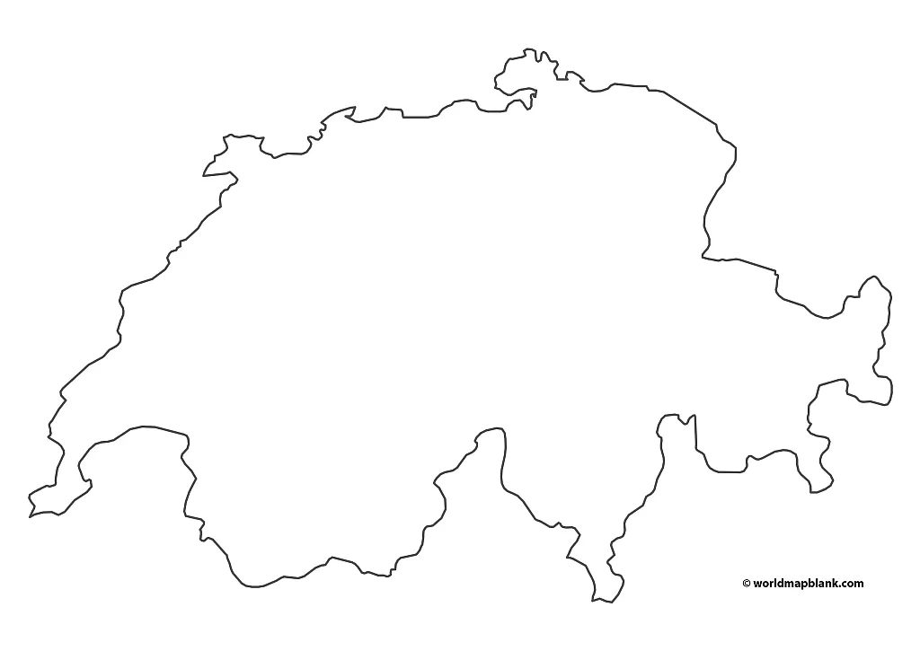
Download as PDF (A4)
Download as PDF (A5)
Use this and our other outline maps of Switzerland for drawing or marking geographical and other features into the map. This could be cities, mountains, lakes, rivers, spoken languages, etc.
Printable Map of Switzerland Outline
Since a significant part of Switzerland is dominated by the Alps, there is a large number of high mountain peaks in the country. The highest mountains in Switzerland are:
- Dufourspitze – 15,203 ft (4,634 m)
- Dom – 14,911 ft (4,545 m)
- Lyskamm – 14,872 ft (4,533 m)
- Weisshorn – 14,783 ft (4,506 m)
- Matterhorn – 14,692 ft (4,478 m)
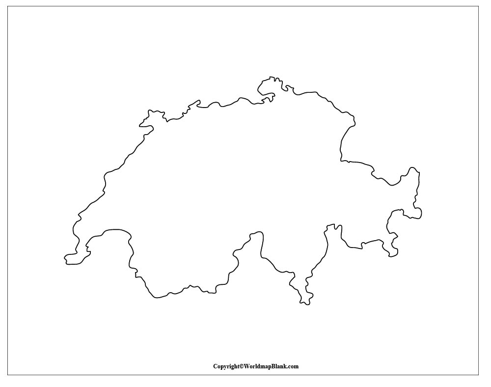
An interesting learning exercise could be to mark the location of the above-mentioned and other mountains on this map.
Switzerland Blank Map Outline
Our following map is a very simple outline map of Switzerland. It is the least detailed map we offer.
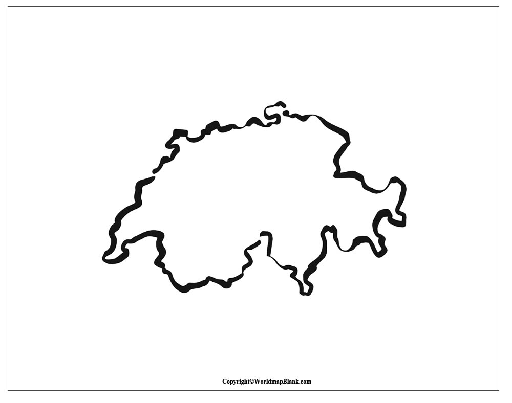
If you need more information already drawn into your blank Switzerland map, please try one of the following versions.
Blank Map of Switzerland
Switzerland is divided into 26 cantons, which together form the Swiss Confederation. Its origins date back to the 13th century when the cantons of Uri, Schwyz, and Unterwalden signed the Federal Charter of 1291.
Here is a list of today’s cantons of Switzerland with their approximate populations (as of 2021) and capitals:
- Zurich (1.6 million)
- Berne (1 million)
- Vaud (823,000)
- Aargau (703,000)
- St. Gallen (519,000)
- Geneva (509,000)
- Lucerne (420,000)
- Ticino (352,000)
- Valais (353,000)
- Fribourg (330,000)
- Basel-Landschaft (293,000)
- Thurgau (286,000)
- Solothurn (280,000)
- Basel-Stadt (196,000)
- Graubünden (201,000)
- Neuchâtel (176,000)
- Schwyz (164,000)
- Zug (130,000)
- Schaffhausen (84,000)
- Jura (74,000)
- Appenzell-Ausserrhoden (56,000)
- Nidwalden (44,000)
- Glarus (41,000)
- Obwalden (38,000)
- Uri (37,000)
- Appenzell-Innerrhoden (16,000)
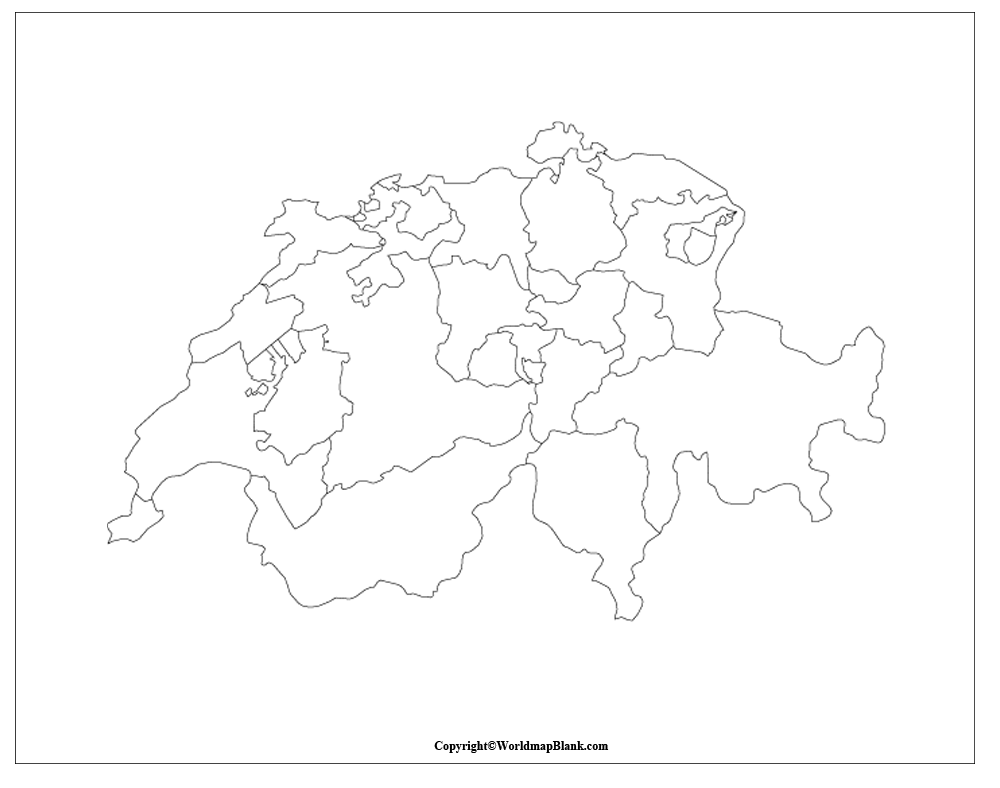
The above map is our first blank Switzerland map with cantons. A variation can be found below.
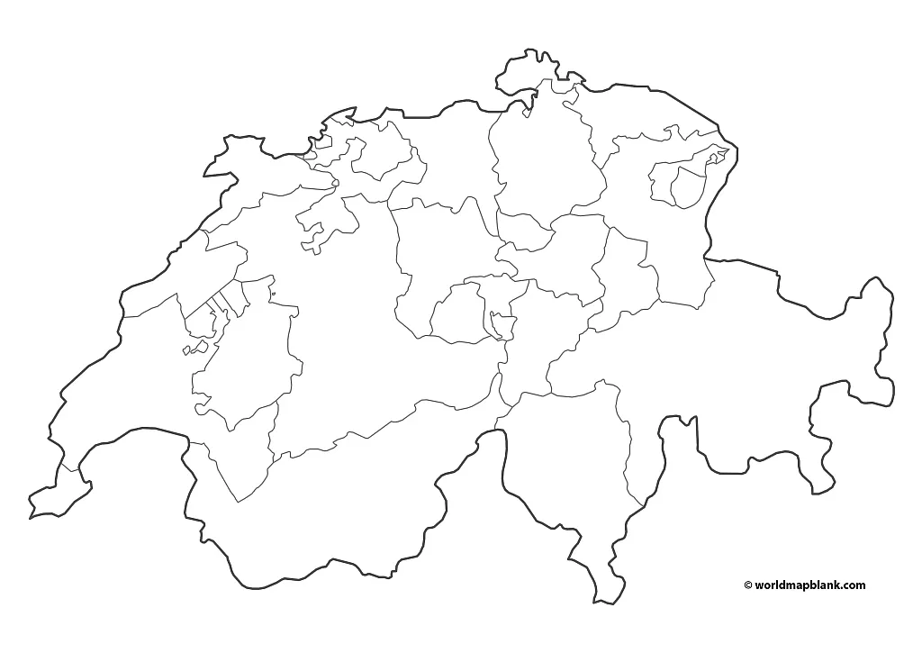
Blank Map of Switzerland with Cantons
Our following map is another blank map of Switzerland with cantons, including all borders within the country. It is particularly useful for coloring exercises to memorize the locations of the cantons and for naming them directly on the map. Like all of our newer maps, you can download this one in two sizes.
Download as PDF (A4)
Download as PDF (A5)
Blank maps of Switzerland are great for classroom use but also for homework assignments and worksheets. You can even integrate them into exams or tests.
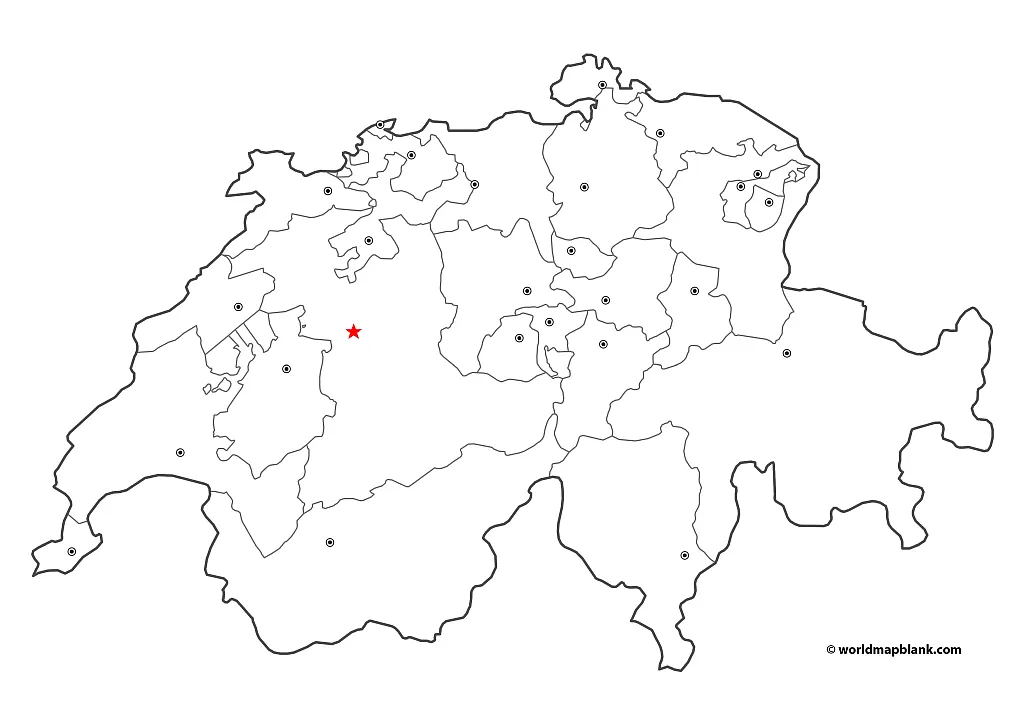
Blank Switzerland Map with Capitals
Our most detailed Switzerland map outline not only includes the canton borders but also the locations of their capitals. The country’s de facto capital city, Berne, is indicated with a star.
This map is perfect for learning different categories of geographic features in one single map. In addition to canton and city names, students can draw rivers, mountains, languages, and more on the map. They might even add the surrounding countries.
Download as PDF (A4)
Download as PDF (A5)
The capitals of the Swiss cantons are:
- Zurich (Zurich)
- Berne (Berne)
- Lausanne (Vaud)
- Aarau (Aargau)
- St. Gallen (St. Gallen)
- Geneva (Geneva)
- Lucerne (Lucerne)
- Bellinzona (Ticino)
- Sion (Valais)
- Fribourg (Fribourg)
- Liestal (Basel-Landschaft)
- Frauenfeld (Thurgau)
- Solothurn (Solothurn)
- Basel (Basel-Stadt)
- Chur (Graubünden)
- Neuchâtel (Neuchâtel)
- Schwyz (Schwyz)
- Zug (Zug)
- Schaffhausen (Schaffhausen)
- Delémont (Jura)
- Herisau (Appenzell-Ausserrhoden)
- Stans (Nidwalden)
- Glarus (Glarus)
- Sarnen (Obwalden)
- Altdorf (Uri)
- Appenzell (Appenzell-Innerrhoden)
More Free and Printable Maps
Download and use any of our maps for school activities, homeschooling, or other educational, professional, or personal purposes. They are all available in PDF free of charge, and you can use the search feature in the header menu to find any specific map you might need. Also, feel free to contact us if your desired map is unavailable on your site (yet).
Here are a few links to other maps you might find interesting and helpful:
County Maps (Europe)
- Map of Germany with States and Cities
- Blank Map of Germany
- Italy Map with Regions
- Blank Map of Italy
- Map of France with Regions
- Blank Map of France
- Bulgaria Map Blank
- Austria Map Blank
- Map of Austria with States
- Map of Sweden with States and Cities
- Blank Map of the UK
Other Country Maps
- Blank Map of the USA
- United States Map with States
- Canada Provinces Map
- Blank Map of Canada
- New Zealand Blank Map
- Australia Map Labeled
- Blank Map of Australia
Continent Maps
- Political Map of Europe
- Blank map of Europe
- Labeled Map of Africa with Countries
- Blank Map of Africa
- Map of South America with Countries
- Blank Map of South America
- Political Map of Asia
- Blank Map of Asia
World Maps
Related Posts


